

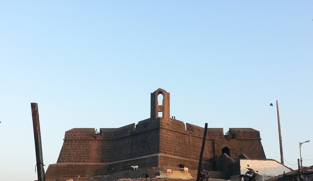
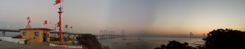
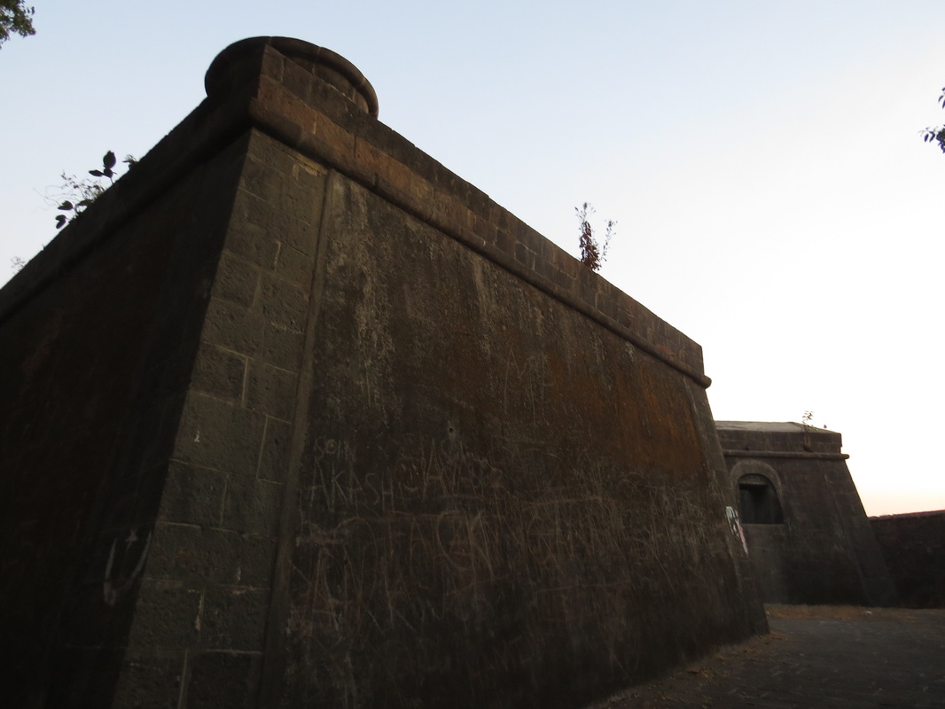
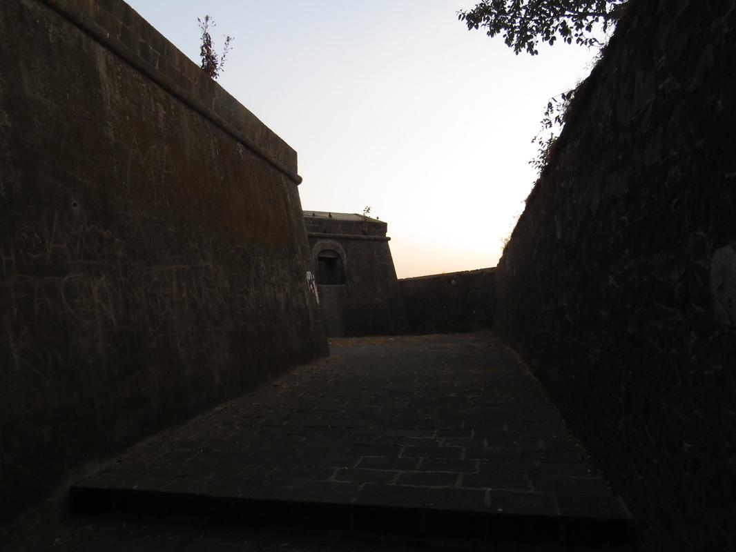
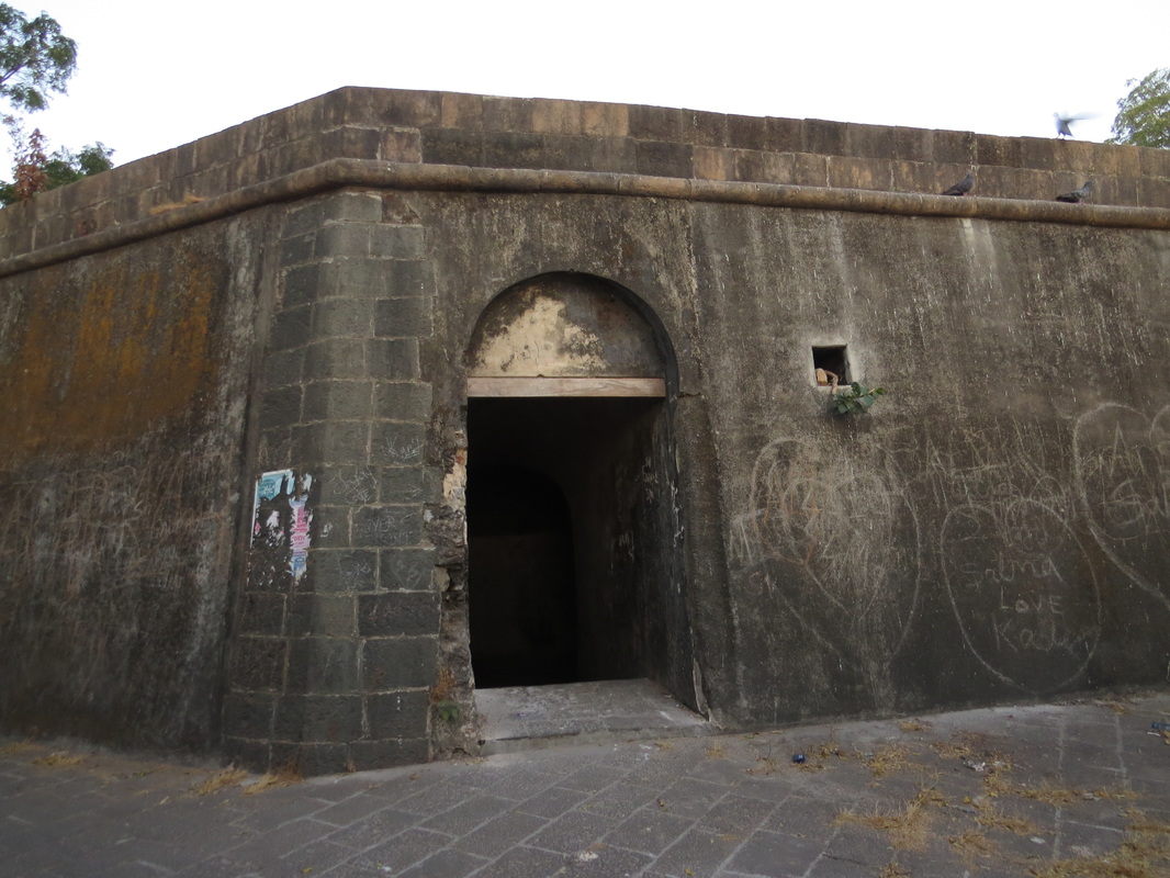
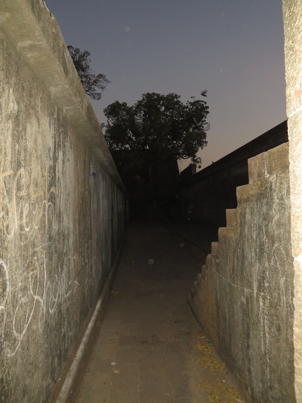
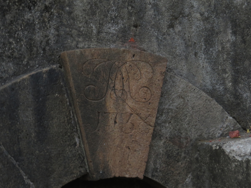
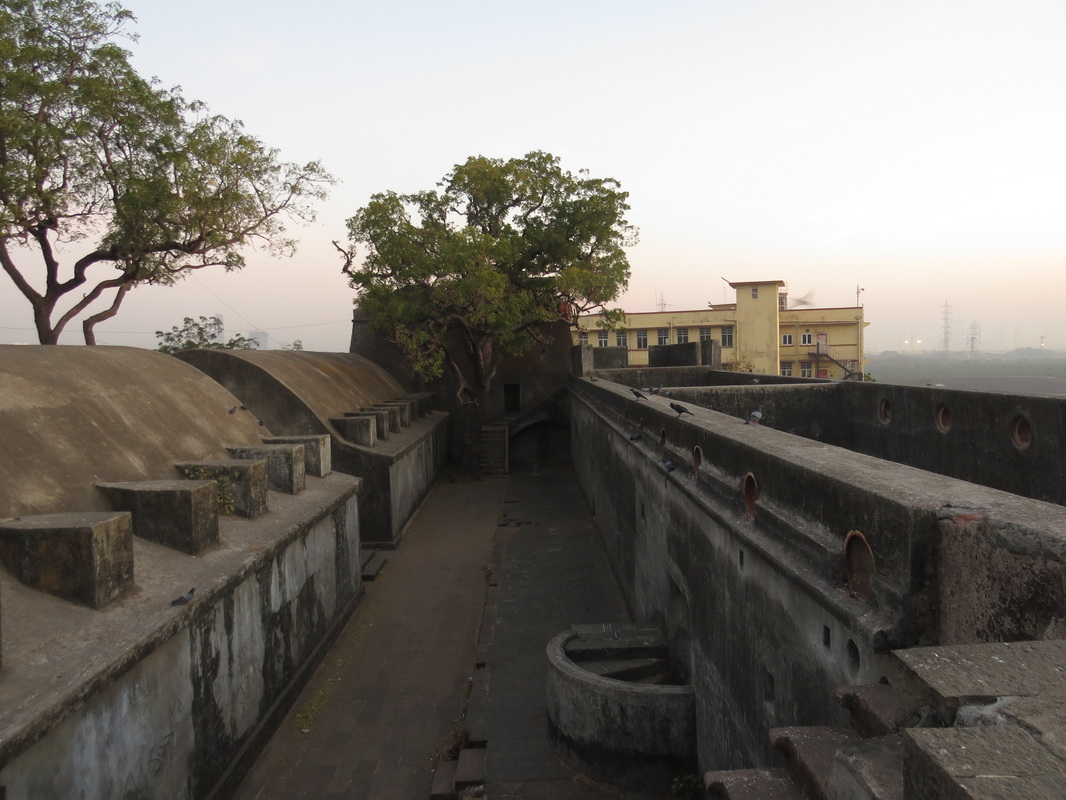
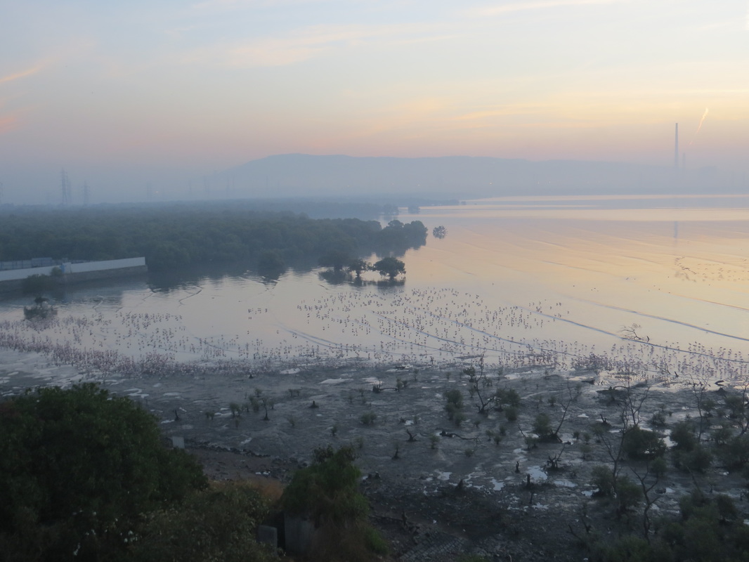
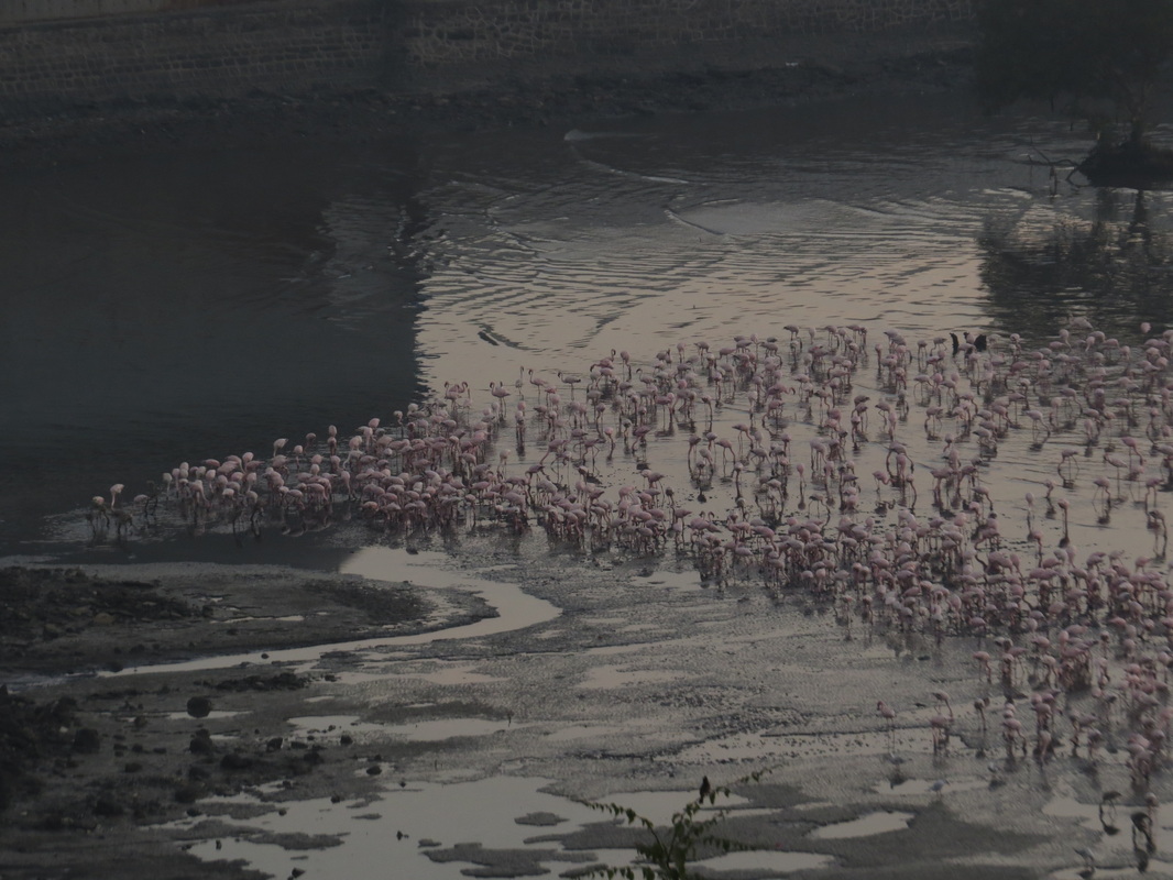
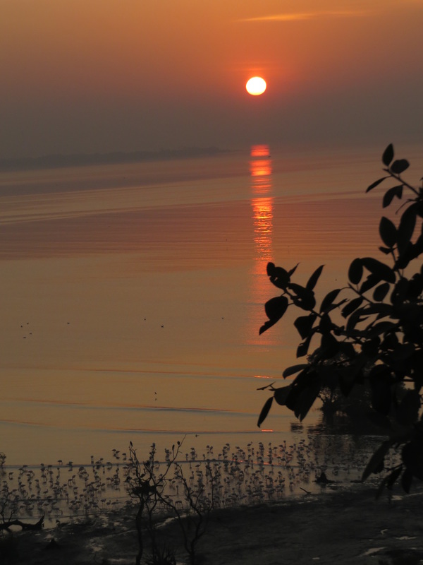
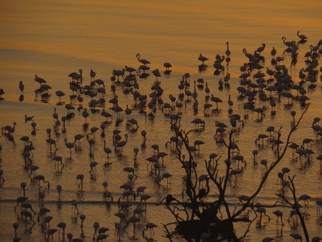
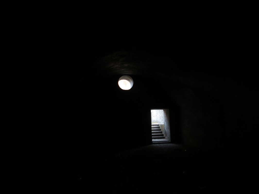
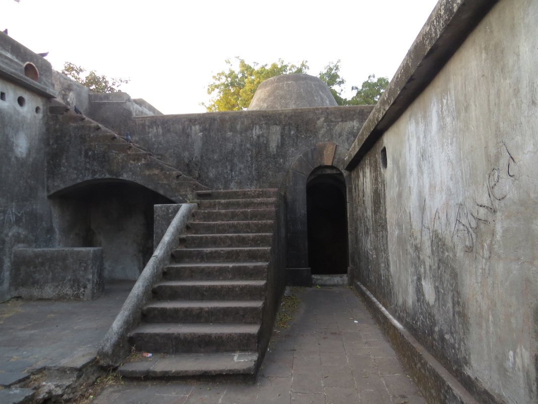
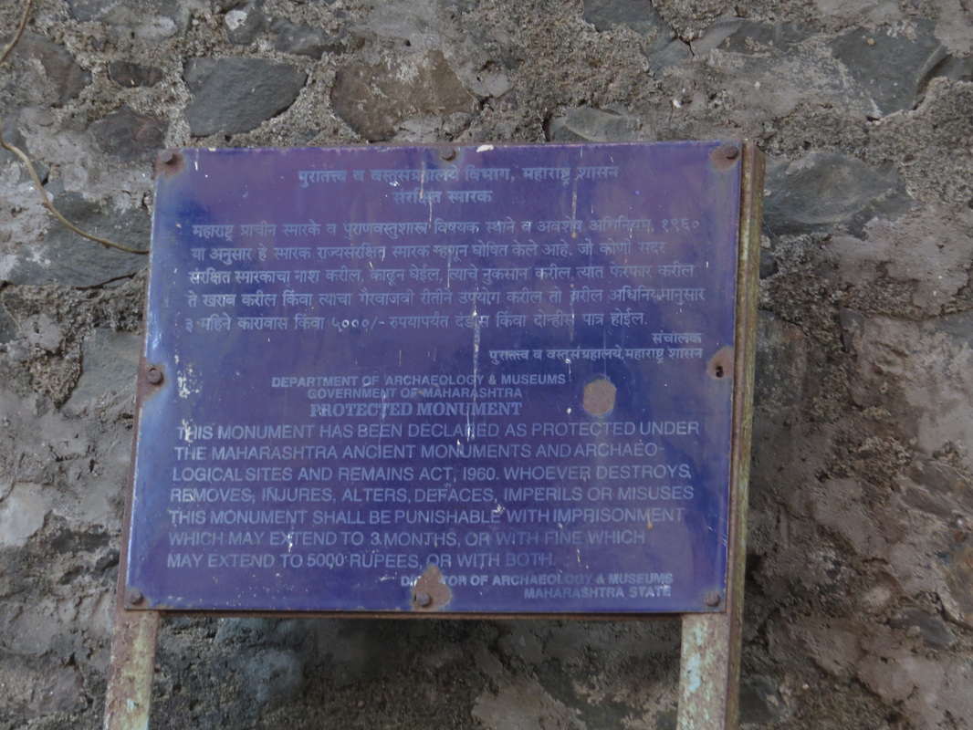
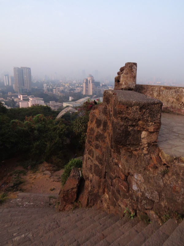
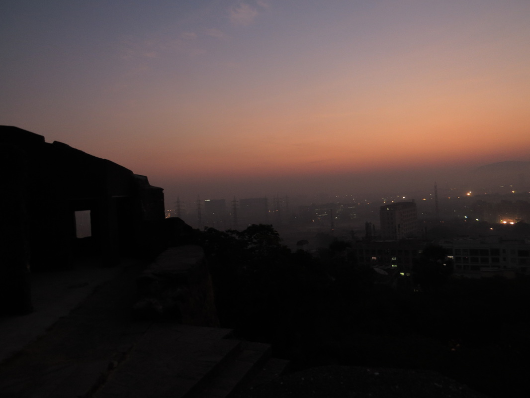
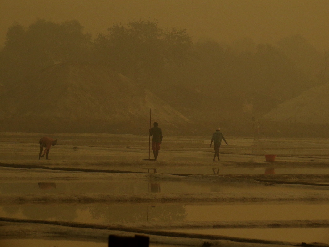
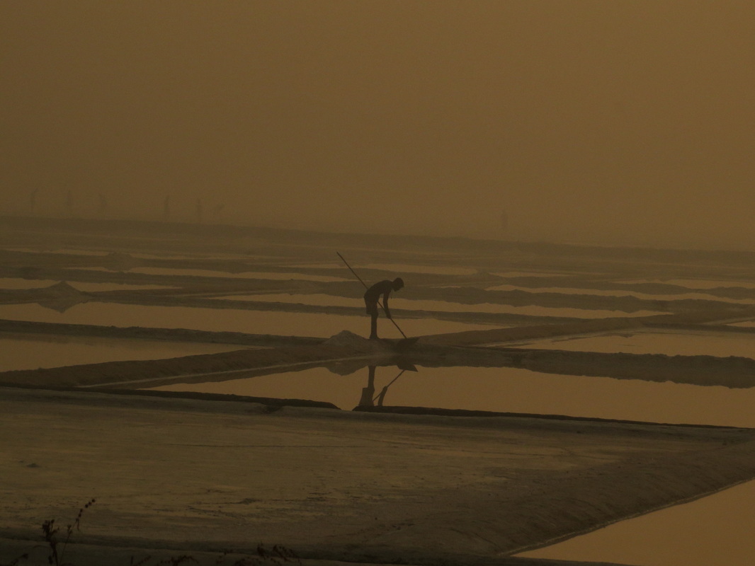
  I woke up at 4.30 AM on Sunday morning. Ain’t that amazing? When you are enthusiastic about doing something, you get up early voluntarily and happily at 4 O clock on Sunday...this new mix of cycling and Bombay discovery is real fun. Today was the day I was tackling my third fort of Mumbai – Worli fort. I have lived here all my life and I didn’t even know that there were so many forts in Mumbai until I started this project. It has been a real eye opener for me, and I am loving it. The fort in Worli was built by the British in 1675 – just about the time that Shivaji had crowned himself King of the Maratha empire, and the British knew that they needed a strong fortified base for themselves. Shivaji was concentrating on the konkan coast and was looking at the Siddis of Janjira and the Portuguese of Goa and Diu as the main enemy. He had built sea forts such as Sindhudurg and Suvarnadurg, and was just getting started on raising a strong navy. The Bombay islands were an irrelevant pointless spit of land at the time and no one thought it worth their while to contest them; and the British East India company took full advantage of this. As you can see in the map below, they ringed the Mahim bay with forts at Worli, Mahim, Dharavi and Sion - the Bandra fort was Portuguese at the time – and made it a really tough nut to crack. 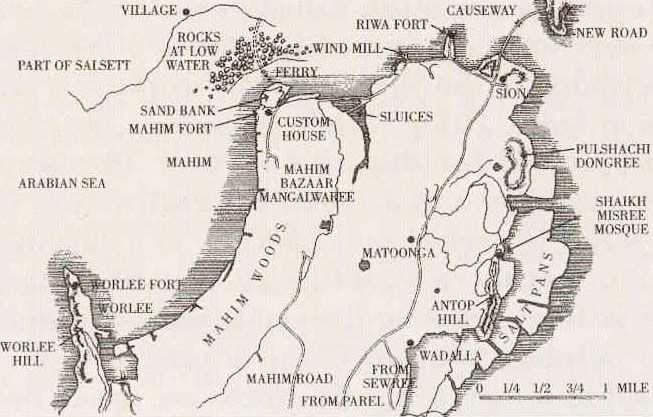 Still continuing my new years resolution to cover all Bombay forts - on bicycle. The first fort I did was Sion fort, because it had been on my mind for so many years - it was really therapeutic to finish it off, it felt like I had finally scratched an itch that had been there for a long time. You can read my blog on that here. The next fort on my list was Sewri fort. It was on my daily ride route, right next to the Sewri jetty where it has been guarding the sea coast for more than 300 hundred years. This fort is also British built, like the Sion fort, and was built in 1680. It was and still is, a sea fort and protected the nascent settlement of Bombay from the naval depredations of the opposing sea forces - competing European powers like the Portuguese who were dominant here, and also to discourage interest by other Europeans like the French, Spanish and Dutch who were all sniffing around Asia at the time. The local sea powers who were also dangerous were the African origin Siddis - based in Murud janjira, the new Maratha navy led by Kanhoji Angre and the feared pirates from the Malabar coast of Kerala. These pirates were so feared that there was a permanent watch tower in South Bombay to look out for them - it was called Malabar hill, and is now one of the poshest addresses in Mumbai. The British were newly planted in Bombay - they had received a few islands which were Charles II's dowry when he married the Portuguese princess Catherine of Braganza, and the local Portuguese were not at all happy about parting with the islands they had conquered almost 200 years ago. They also knew that the Europeans had been unmolested for so long and allowed to create coastal fortified cities because the preeminent powers in Hindustan - the mughals, the deccan sultanates and even the marathas - were primarily land based empires and did not know anything about sea power. But Shivaji was a local king who had woken up to the threat of the European warships, advanced weapon technology and army science, so the British were under time pressure to develop a strong base before they got chucked out as undesirable aliens. And obviously the current sea power - the Siddis - were seething with rage at seeing the British rising as a dominant sea competition and wanted to wipe them out. In fact, shortly after the fort was made in 1680, Siddi Jakat attacked the fort in 1689 with a huge force of 20000 men and captured it, and Mazgaon fort and burnt the city of Mahim. However, as we all know, the Brits won in the end and became so powerful that the little fort of Sewri became unimportant and forgotten. With no regional enemies to fear, it was not required as a fighting fort, and was used as a prison, and then transferred to the Bombay Port Trust and they used it as a godown. I had cycled by it several times and never even noticed that there was a fort there. But this time I went looking for it and saw a little path leading up a steep slope. Just as I was downshifting gears and getting ready to battle the slope a little girl came running up to me. 'Please give us a kick!' she pleaded. Huh? What was this strange masochistic request? It turned out that she wanted me to kickstart her mom's scooter as mom couldn't get it to start and they were getting late for school. I did so, much to their relief, and off they went to a day of pedagogy. I went up to the fort and was impressed by how well maintained it was! Sure it had been restored with a little too much cement and concrete for a purist's taste, and there was a bit of graffiti and litter, but it was much nicer than what I had expected. It felt nice and tranquil, and gave the solid and unchanging vibe that you get in forts. It was a lovely place. I climbed up to the roof and gasped as saw the beautiful sight of the coastline, the rising sun and the hundred and hundreds of flamingos which had reached there for their morning feeding. I climbed to the edge of the roof and sat there for a long time, just soaking in the view. Glorious. Awesome. Heavenly. I had to really tear myself away from there after half an hour as it was getting time to go home. Also, I now discovered that I had been sitting in a puddle of bird shit and needed to get home and wash. On the way out I saw that the martial connection of the fort was still alive, as it was next to the residential quarters of the Central Armed Police Force. Apparently they are there for our 'Proction'. And Security. Good to know. I also noticed a small and faded sign of the Archaeological Survey of India. As is usual with ASI, they give no useful info about history and significance of the place, but only vague threats of arrest and torture if you disfigure anything. Apparently the ASI was going to beautify and restore the place and put in a garden and promenade and amphitheater and a food court. They got a multi crore budget for it in 2008...its 2016 now, and no progress yet. Maybe that's a good thing. Let this old fort sit alone and brood and think of long ago battles and bloodshed. -------------------------------------------------------------------------------------- PS : I would strongly recommend Ashutosh Bijoor's blog where he has cycled to all sorts of awesome places in and around Mumbai. This is his blog about his visit to Sewri fort  This is is the year of doing new things ! One of these was to complete the long pending visit to the forts of Bombay. I had been wanting to do this for several years, and never got around to doing it. But now was the time – I was looking for a new destination for the Sunday ride anyway –I would start by going to Sion fort. Sion is called ‘Shiv’ in Marathi – and that means ‘Boundary’. So this was the far boundary of the British East India colony of Bombay and they had built this fort way back in 1677 – 350 years back! Shivaji was on the throne of the nascent Maratha empire, and Aurangzab was badshah of the powerful Mughal empire. Gerald Aungier was the Governor General of Bombay then, and he was the British official who sent emissaries to Shivaji’s coronation in Raigad. In fact Aungier was at Surat when Shivaji attacked it, and that was what made Aungiers decide to move the seat of British government from Surat to Bombay – where he could build his own forts and carve out his own territory. For this they developed forts in Colaba, Bandra, Dongri,Dharavi, Madh, Mahim, Mazagaon, Sewri and Worli. This was just after the original 7 islands had been transferred to British rule in 1661 as part of the dowry of Catherine of Braganza, and the Brits would have wanted to protect their property with forts. When it was built, it was a sea fort! There was a large Sion creek which marked the boundary of the British-owned Parel island and the Portuguese-owned Salsette island that lay to the north across the creek. Salsette was basically the area North from Sion - from Bandra - Kurla till Thane Bhayendar. There was a huge creek at the time, and this was the boundary between the 7 British islands and the Portugese territories. It was originally known as ‘Sasasthi’ – Marathi for ‘66’ which referred to the 66 villages in that area, who apparently trace their conversion to Christianity way back in 55 AD (read that again – 55 AD.... when there wasn’t a single Christian in Europe!) by the arrival of Christ’s disciple St. Bartholomew in North Konkan. Interestingly, the Christians here are called ‘East Indians’ though they live on the West coast. That’s actually to differentiate them from people in the Caribbean islands of Jamaica, Barbados, Trinidad and Tobago etc – i.e the West Indies. You see, Columbus had been looking for India when he blundered into America – he was sure that he had found India, and so he referred to the locals as ‘Indians’. After the actual India was discovered, they made the differentiation by calling them ‘Red Indians’ or ‘West Indians’. Anyway – after the British became the main power in India, they kicked the Portugese out of Salsette and took it over, then defeated the Marathas in the Anglo- Maratha wars and became the only power in the area. To develop trade they built a road across the creek in 1803 and called it the Sion causeway. They used to charge a toll to use it – so we have a really long tradition of toll roads in Mumbai. In due course of time all the creeks were filled in, and the swampland was reclaimed and the city of Greater Bombay came into being and the Sion fort became irrelevant. I went to seek out this fort, and was very happy to see that they have developed a nice garden around it. It was full of walkers and joggers, and they were not even aware that there is a fort in the middle of the garden area. The fort was in surprisingly good condition, and was clean and rubbish free. I climbed to the top of the little watch tower and got a great view of the surrounding area, and the Sion Trombay road. I sat there for some time and watched the sun come up, and thought about the march of history, and the ebb and flow of empires and the amount of blood and money that must have flowed, leaving behind this empty stone ruin. Nobody cares about it – I thought - no army will fight for it now... and suddenly I heard the sound of running feet. I looked up to see a squad of NCC cadets come running up. The squad sergeant gave me a surprised look – not many people must be coming to this place so early in the morning – and then got back to drilling his troop through their morning exercises. I smiled as I came down – there was still a little military connection left in this old fort. 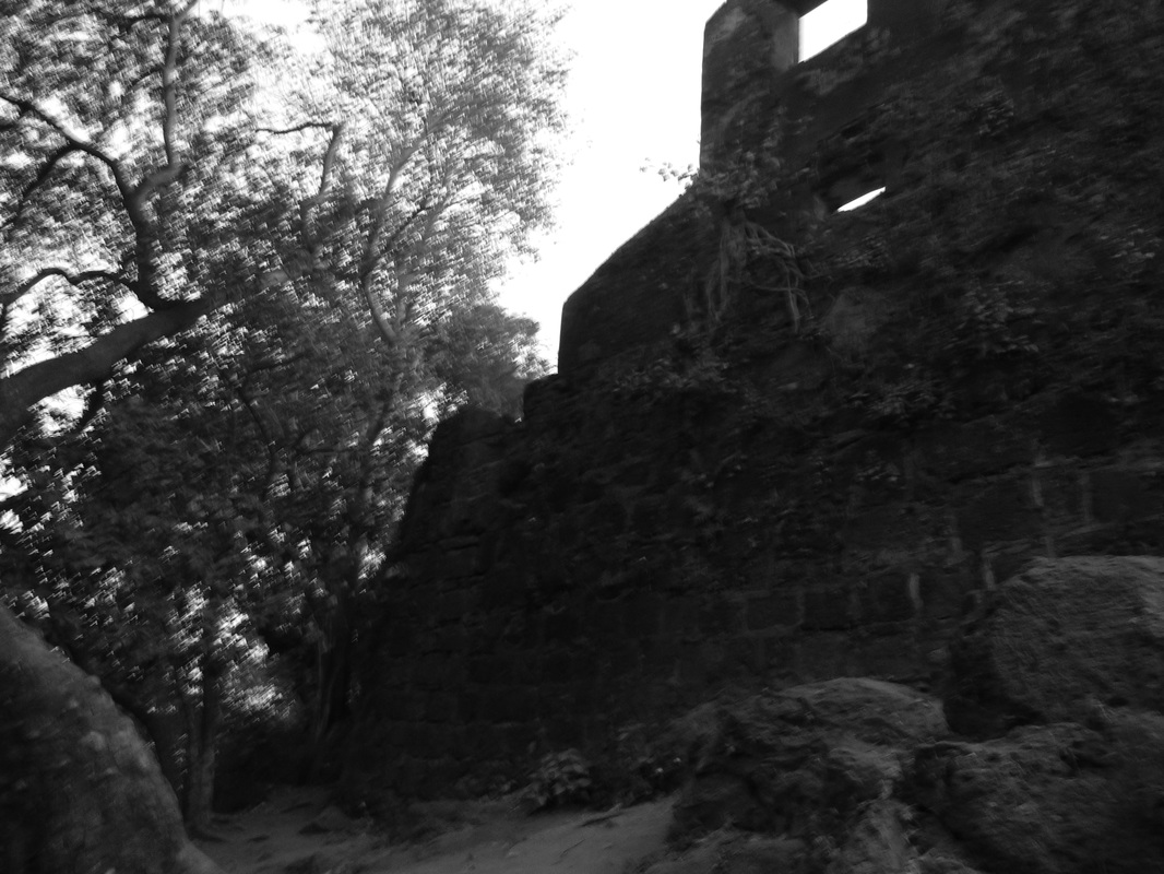 The original inhabitants of the Bombay islands were the 'koli's - which is fishermen, and the 'agri's - which means saltmakers. The salt pans are still alive and people still make salt the traditional way - allowing sea water to enter the salt pans, and then trapping it and allowing the sun to dry off the water and leave the salt behind. It's nature's bounty - but it's hard work to collect it and clean it and store it and sell it |
Categories
All
Hi thereI blog about my travels - and the thoughts they set off! Sometimes the simplest destinations can be the most thought-provoking! 
Archives
May 2022
|


 RSS Feed

Copyright © 2015