The painted valley - Jujuy
WOOHOOEY - I was riding to HUHUY.
It’s actually spelt JUJUY - as I mentioned earlier - and all the locals laughed at me when I pronounced it the way it was written - JOO JOO EE.
‘You ignorant buffoon!’ they seemed to be saying. ‘Don’t you know that in Spanish, what is written as ‘J’ is pronounced as ‘H’? ‘Jose’ is ‘HOE SAY’ and ‘Juan’ is ‘HOO AN’. Even ‘Jesus’ is pronounced as ‘HAY-SOOS’.’
‘Oh?’ I would say, all abashed. ‘OK - whatever you say. Tell me, where should I go in Huhuy - I mean - Jujuy?’
‘Oh! You must go to Humahuaca! It’s a wonderful place! Colourful mountains and all that.’
‘Humahuaca?’
‘Humahuaca!’
‘WHO MA WHO AA KAA?’
‘Er…no… it’s pronounced… OO MA GOO AA KAA’
I threw my hands up in despair. This language seems to have been designed just to trip up foreigners.

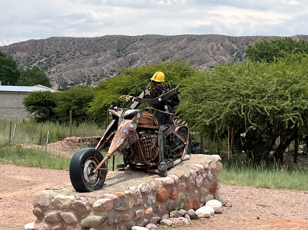
On the way back, I smiled at the name of a pizzeria - it was called ‘Hell’s pizza!’. What a name!
‘Abandon all hope for your bowels, ye who eat here!’
‘Abandon all hope for your bowels, ye who eat here!’
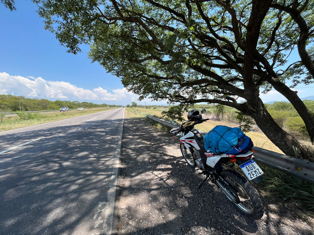
I fuelled up and set out - striking northwards towards HOOHOOEE! WOOHOOEE!
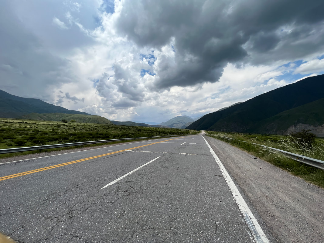
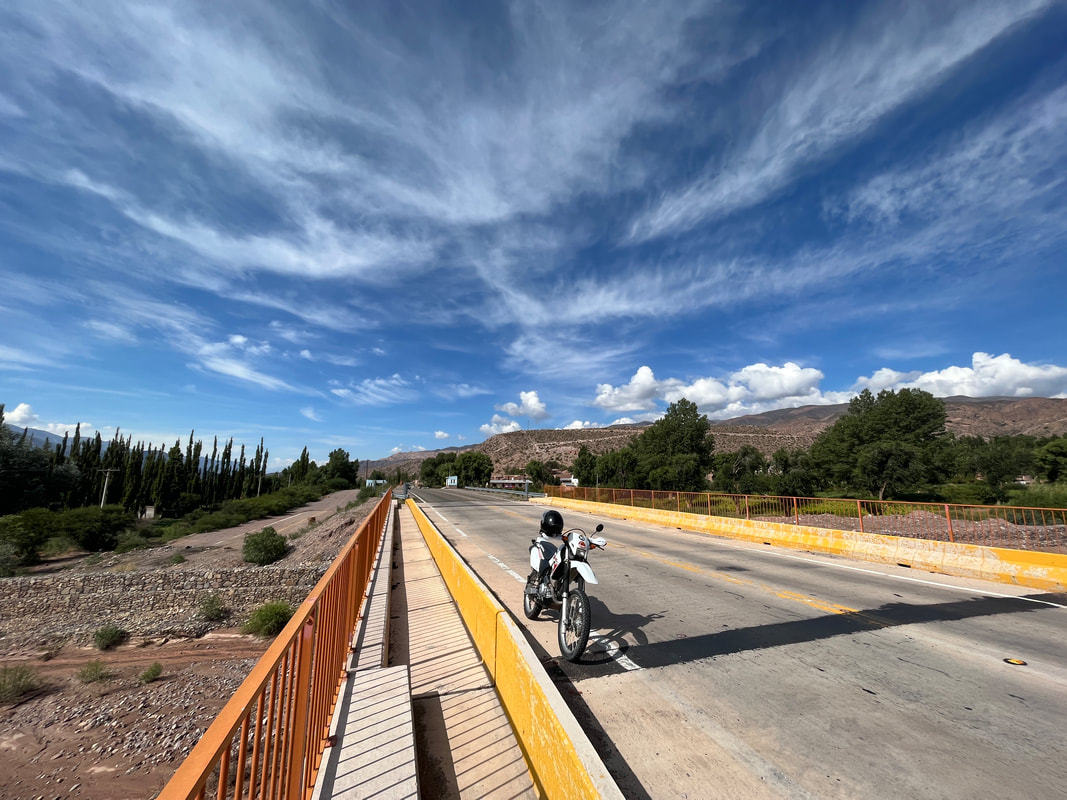
My route was quite straightforward - I would join Ruta 9 out of Salta…and continue along Ruta 9 …all the way till Humahuaca! No left, no right - everything is fine on Ruta 9! Even I couldn’t get lost on that!
My route was quite straightforward - I would join Ruta 9 out of Salta…and continue along Ruta 9 …all the way till Humahuaca! No left, no right - everything is fine on Ruta 9! Even I couldn’t get lost on that!
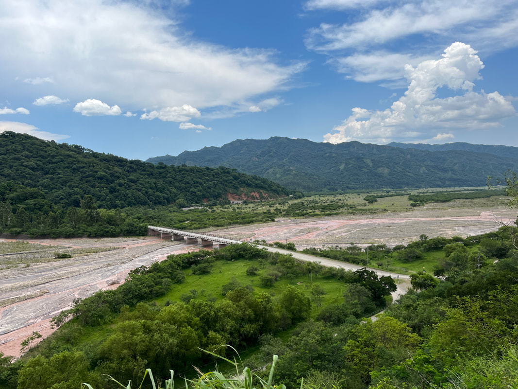
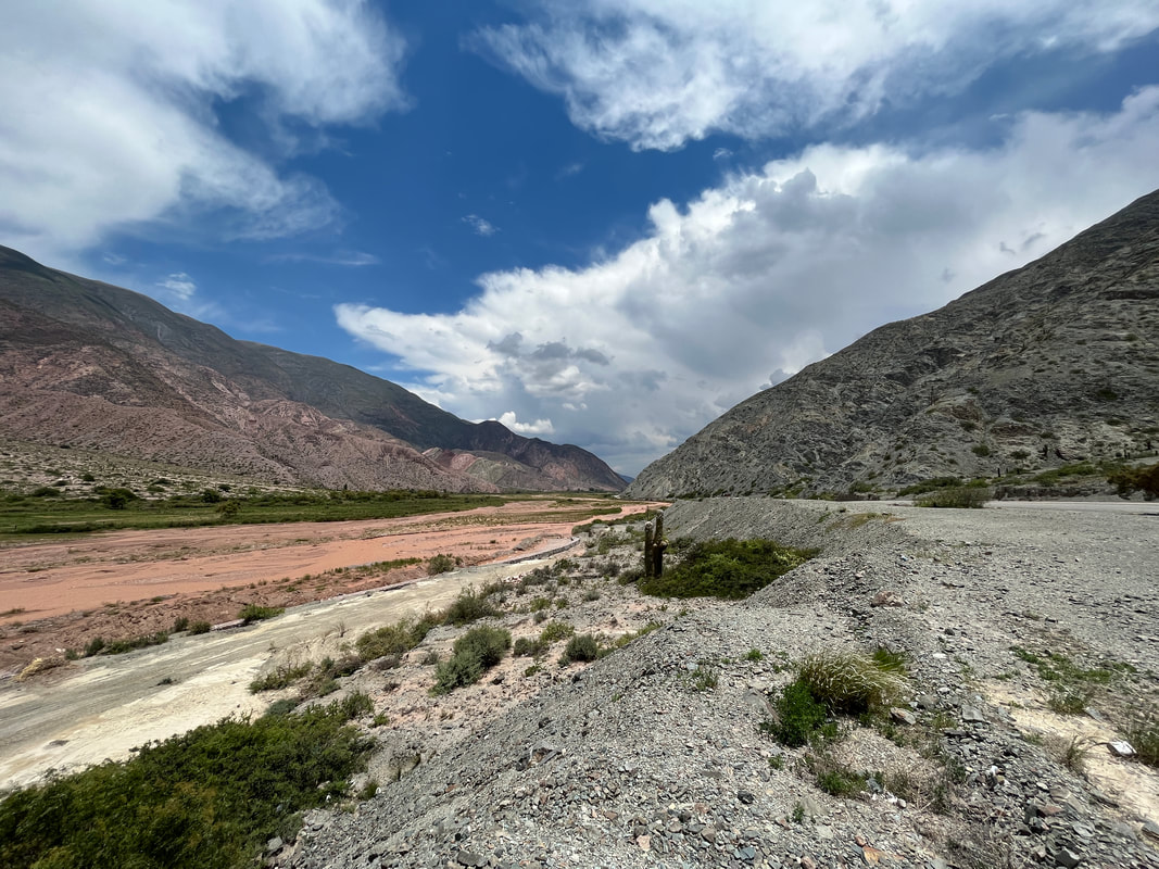
The road runs alongside the mighty Rio Grande - the ‘Great river’. The Spaniards really had no originality in naming rivers… there must be half a dozen ‘Rio Grandes’ all over the Spanish commonwealth. There’s one here, one in Tierra del Fuego, one in Brazil, one in the US - and probably dozens more.
I can just imagine Hernan and Jose finding a river.
‘Yo, Hernan my hermano - That river looks really grand! What shall we call it?’
‘Jose, my hombre! I have the perfect nombre! Let’s call it … ‘Grand river’! ‘
‘What an awesome idea, chico! You da man! No one else will ever think of it!’
I can just imagine Hernan and Jose finding a river.
‘Yo, Hernan my hermano - That river looks really grand! What shall we call it?’
‘Jose, my hombre! I have the perfect nombre! Let’s call it … ‘Grand river’! ‘
‘What an awesome idea, chico! You da man! No one else will ever think of it!’
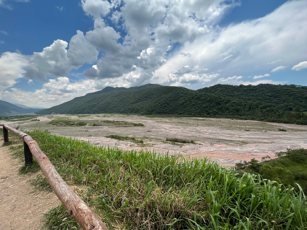
This Rio Grande is the creator of this ‘quebrada’ or ‘valley’. It runs from the ‘Puna’ - the high plateau of the Andes - down towards Salta and flows through the most awesome natural scenery till the the city of San Salvador de Jujuy.
Interestingly, it is almost dry in the winter and carries much more water during the summer season - due to the rains and meltwater.
Interestingly, it is almost dry in the winter and carries much more water during the summer season - due to the rains and meltwater.
The Quebrada de Humahuaca, located in the Province of Jujuy, is a narrow and arid mountainous valley, flanked by the high plateau of the Puna and the eastern wooded areas. It is located in the north-westernmost portion of the Republic of Argentina and follows the line of a major cultural route, the Camino Inca, along the spectacular valley of the Rio Grande, from its source in the cold high desert plateau of the High Andean lands to its confluence with the Rio León, forming a 155-kilometre long, north-south striking natural corridor, where the Grande de Jujuy river flows.
The region has always been a crossroads for economic, social and cultural communication. It has been populated for at least 10,000 years, since the settlement of the first hunter-gatherers, which is evidenced by substantial prehistoric remains. In particular, many stone-walled agricultural terraces, thought to originate more than 1500 years ago, are found throughout the region and are still in use today.
The field system links a series of fortified towns called pucaras. The valley was later a caravan road for the Inca Empire in the 15th century, and this was one of the first areas of Argentina explored by the Spanish on their way from the Altiplano to the warmer climates of Salta, Cordoba and on to Buenos Aires. It was then an important link between the Viceroyalty of the Río de la Plata and the Viceroyalty of Peru, as well as a stage for many battles of the Spanish War of Independence.
The Quebrada de Humahuaca was designated a protected landscape in 2000, and it was made a UNESCO World Heritage Site on 2 July 2003.
Imagine that…the whole valley is a World Heritage Site!
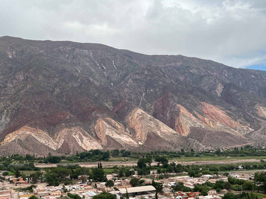
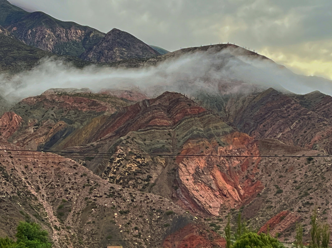
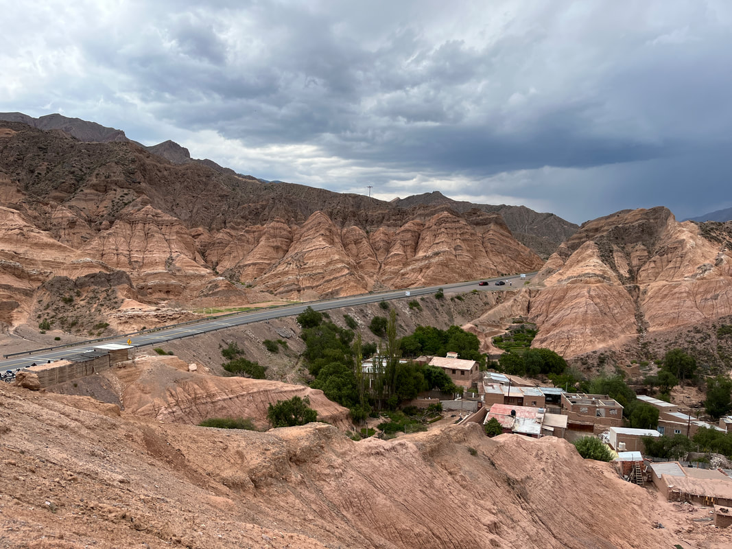
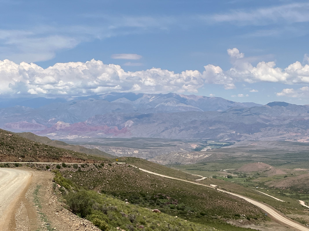
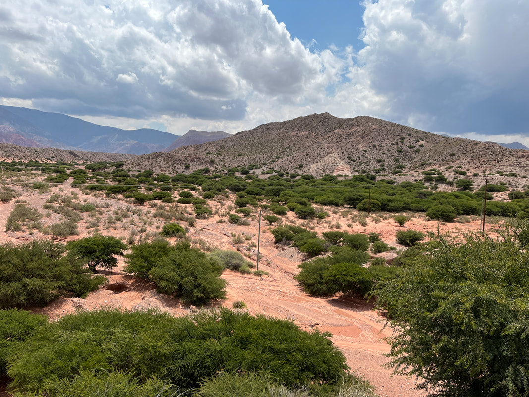
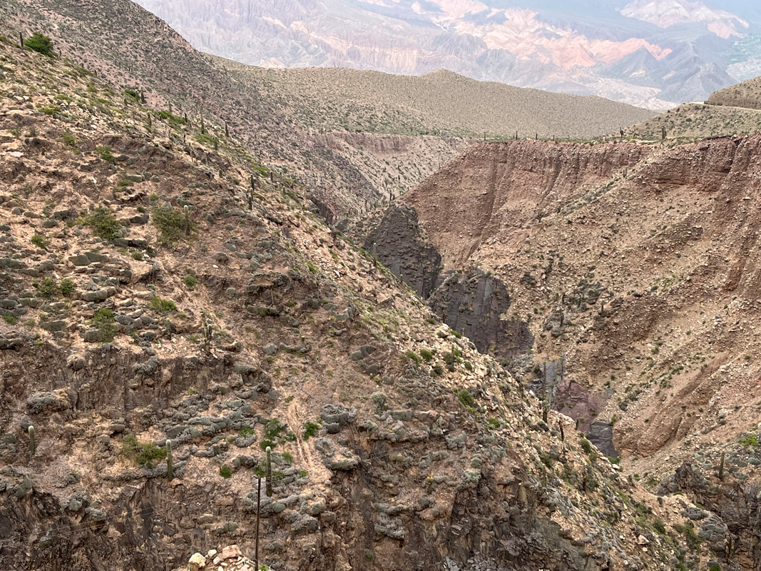
In the flatter valley areas, the earth is a coppery orange-red, dotted with every imaginable shade of green. The mountains that jut up out of them are every color imaginable, forming almost a rainbow of reds, yellows, even blues and deep purples. Around each turn comes a new design as if painted by an abstract landscape artist.
It’s a harsh but vivid landscape, a network of dry yet river-scoured canyons overlooked by mountains with sedimentary strata that have been eroded into spectacular scalloped formations revealing a spectrum of colors in undulating waves. The palette of this World Heritage–listed valley changes constantly, from shades of creamy white to rich, deep reds; the rock formations in places recall a necklace of sharks’ teeth, in others the knobby backbone of some unspeakable beast.
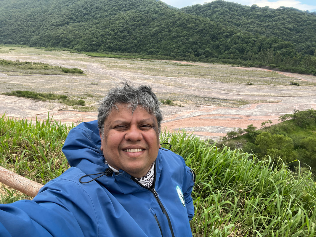
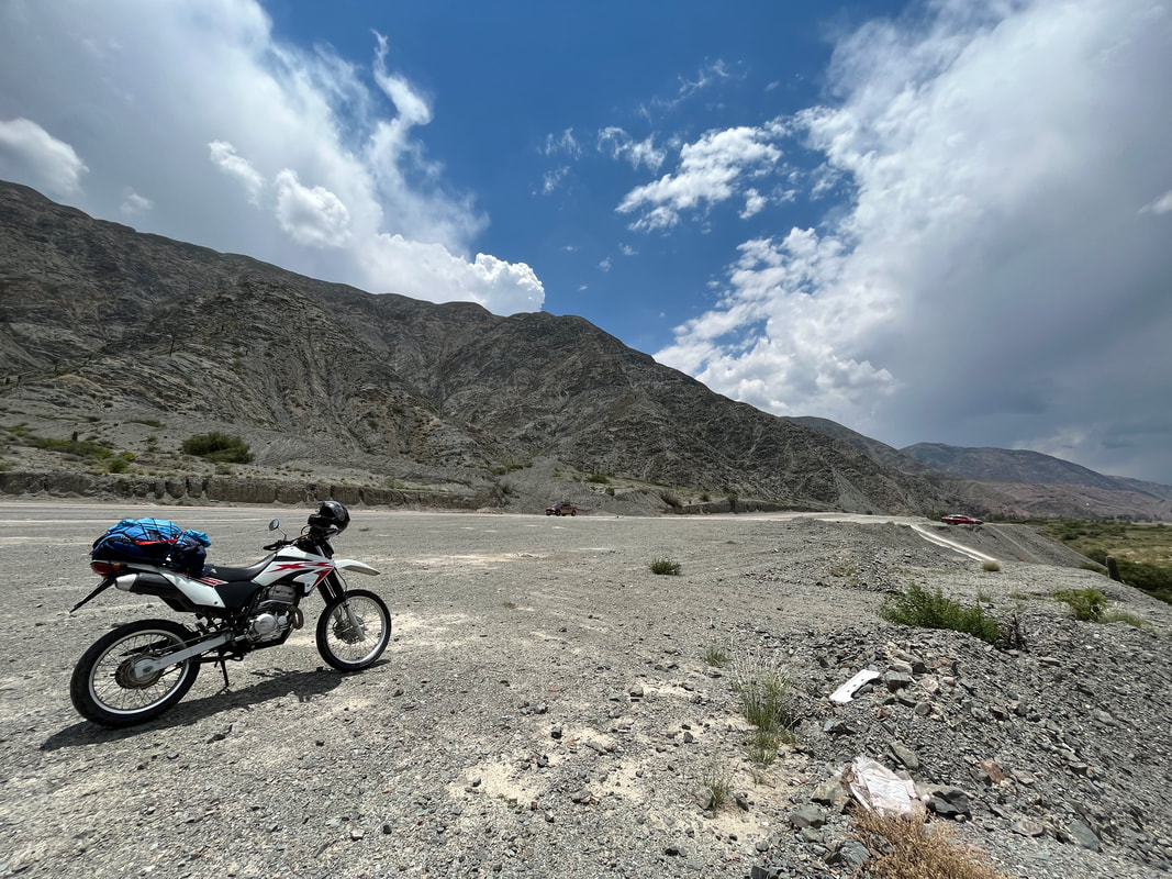
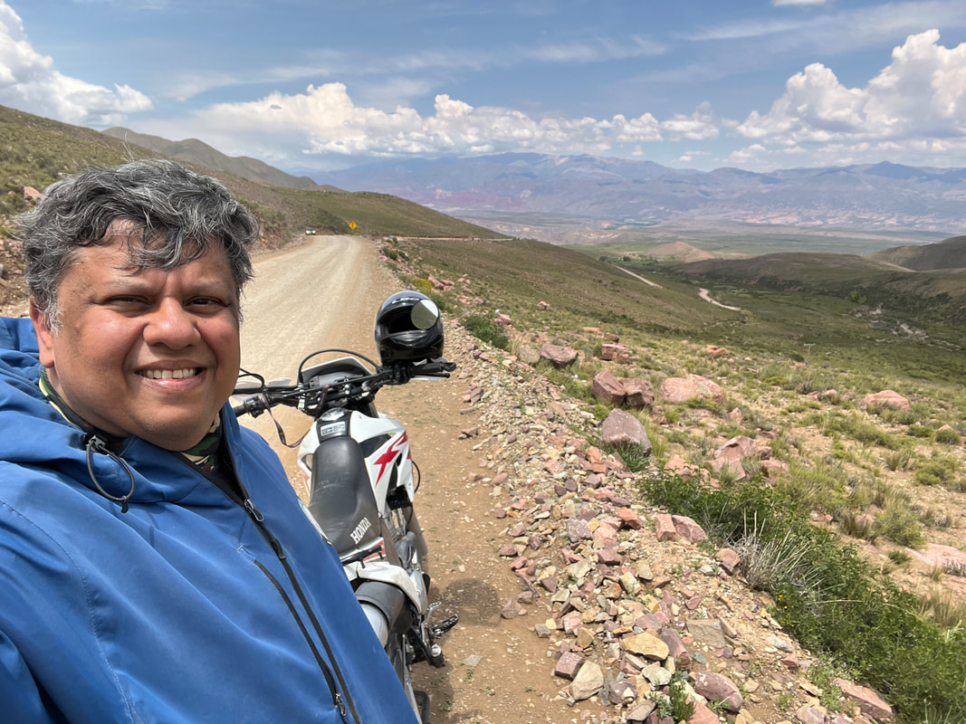
I was using any excuse to stop and dismount and admire the landscape.
Ass paining? Stop and dismount.
Bridge over river? Stop and dismount.
Mirador viewpoint? Stop and dismount.
Clear view? Stop and dismount.
Ass paining? Stop and dismount.
Bridge over river? Stop and dismount.
Mirador viewpoint? Stop and dismount.
Clear view? Stop and dismount.
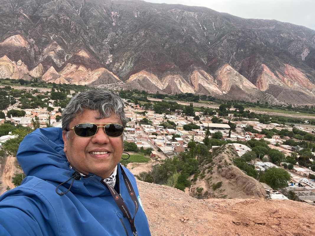
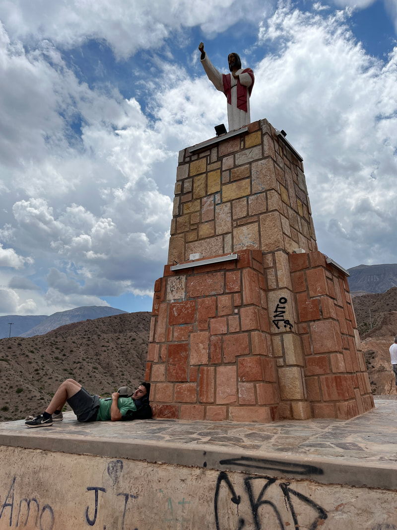
But then I came to the town of Maimara - and saw the ‘Las Paletas Del Pintor’ - the ‘painters palette’. The mountains behind the town of Maimara are simply incredible - they are like a bigger version of the seven coloured mountain in Purmamarca. The geological formations that defy logic and form colourful layers which become folded up like a stack of napkins which gets smooshed up in my linen cupboard.
The townsfolk have built a mirador there, with a giant statue of HAY-SOOS blessing the town - or admiring the view… take your pick.
The townsfolk have built a mirador there, with a giant statue of HAY-SOOS blessing the town - or admiring the view… take your pick.
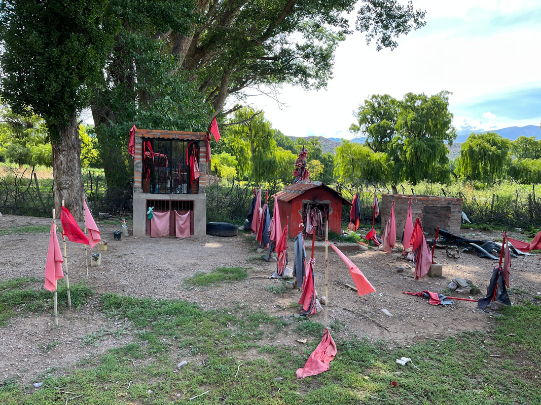
One thing which was making me very curious was the many shrines on the side of the roads, marked with red flags. This struck me as being very Indian - the practise of marking roadside shrines with red flags is very common in India.
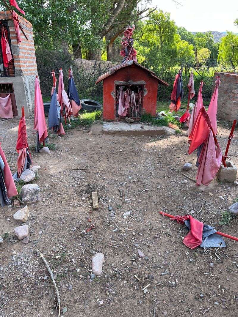
I stopped at a shrine to check it out - and saw to my surprise that it was not dedicated to HAYSOOS, or Mother Mary or any popular saint. There was an idol of a moustachioed dude with a red bandanna, dressed in blue shirt, white pants and black jacket. There was a sign behind the idol ‘Antonio Gil’ and below that was written ‘Gauchito Gil’
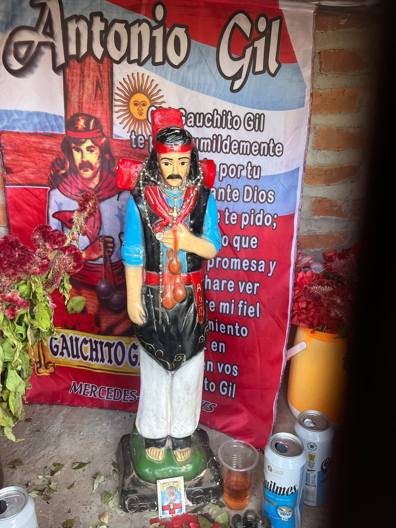
Antonio Gil was a cowboy - a ‘gaucho’, and is therefore lovingly referred to as ‘Gauchito’ (little or beloved cowboy) Gil. He is like a saint and is mostly followed/prayed to by truckers. That’s why there are so many along the roads. They ask him for protection and safe travels. In prison, felons tend to get large tattoos of him.
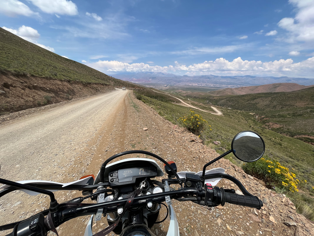
The Serranía de Hornocal are a range of mountains located 25 kilometres (16 mi) from Humahuaca. They are extremely colourful - like the ‘Painter’s palette’ on steroids! These mountains are part of a colourful calcareous formation called Yacoraite – overlapping veins of different colors –, which extends in a line from Peru, down through Bolivia and the Quebrada de Humahuaca, ending in Salta. The Hornocal mountain ranges are 25 kilometers from the city of Humahuaca and are not well known because they are reached by a narrow gravel road.
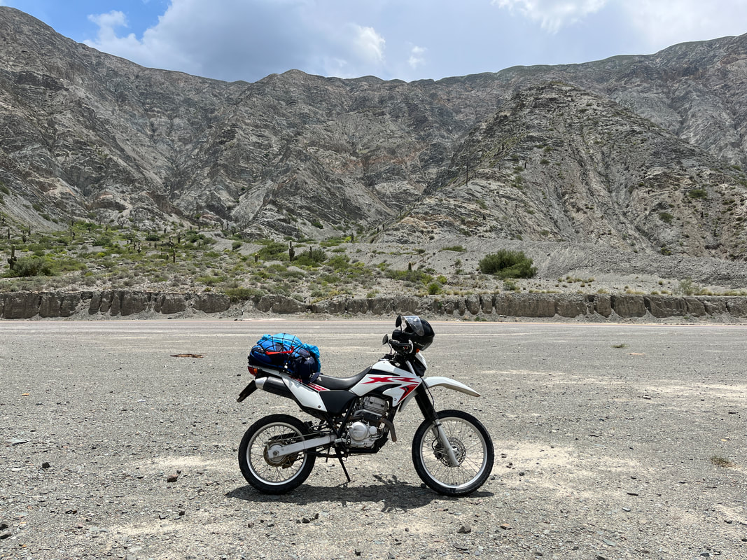
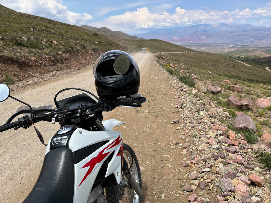
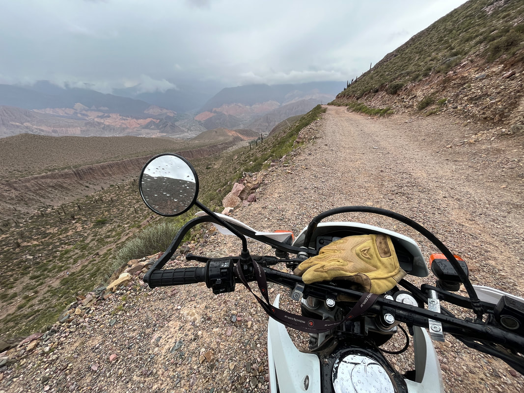
I quickly discovered this - the road very quickly became an unpaved gravel road - and started climbing steadily! I was not concerned - the road was well graded and had no potholes or rocks on it, so it should not pose any problems to my Tornado. It was an adventure bike after all - made for bad roads! And I was used to Indian mountain roads - which can be reeeeeeeally challenging. So Hornocal - no biggie.
I passed various interesting points - and finally turned in at a handicrafts shop. This must be one the highest handicrafts shops in the world! Actually, I had no interest in handicrafts - but the sign said that he also sold soft drinks - and I was in need of one! It was HOT and the thin air was getting to me. I was pleased to see that he also sold beer! Ah - but since I was going to be riding very high up, I decided to stick to virtuous soft drinks.
Rested and refreshed, I again hit the road - but now my bike was having serious problems. The poor thing had lost all power and was groaning and moaning like a foundering horse. It lost all power, and was just crawling along, like an overloaded mule about to drop dead! I thought that the bike had become hot and tired and that’s why I had taken a break at the shop. I had hoped that the bike would cool down and get back into shape - but it was clear that the break had not helped.
The bike was struggling, poor thing. It was gasping and wheezing. I put it in first gear and twisted the accelerator as far as it would go, but it was just crawling along.
‘C’mon Tornado…’ I pleaded ‘It’s just 4 kilometres more…buck up!’
‘ONE OF YOU TWO GUYS, GET OFF!’
’Er…it’s just me….’
‘OH! THEN FORGET IT! I CAN’T GO ANOTHER STEP!’
‘But you have wheels… you don’t take steps…’
‘OH,DON’T BE PEDANTIC!’
‘Just a few km…’
GASP WHEEZE
I DIE…
And the poor bike just couldn’t go on. The thin air at the high altitude killed it completely! I thought that maybe it was not able to take weight, so I got off the bike and tried to wheel it along, but it couldn’t move forward even with zero weight on it. I tried tweaking the carburettor to make the fuel mixture richer - but it was of no use. The engine made more noise, but generated no power.
The ride was done.
I mean - the onward ride was done! The bike was ready to go down - but had no strength to go up.
Ah, dammit! I won’t be seeing the hornocal after all. What a pity.
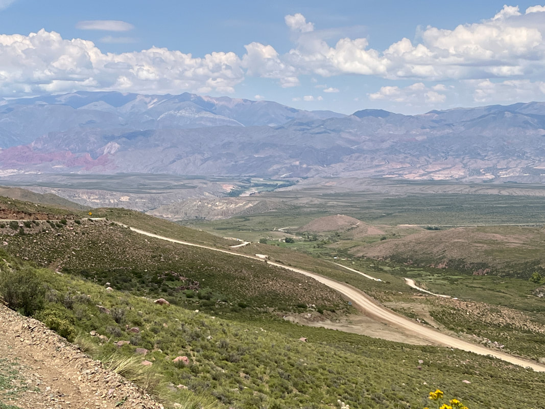
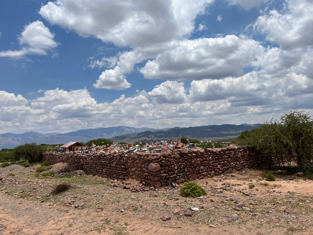
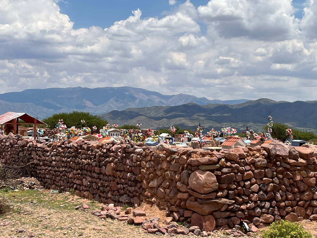
I went slowly down the winding mountain roads, enjoying the views - passed a lovely colourful graveyard - and finally came down to the main road.
On the way, I saw a tourist-trap place - a huge handicrafts shop with a giant llama figure on top of it. And as I got closer, I saw that they had a little herd of actual llamas in front of it! How cool was that! I stopped and went to check them out.
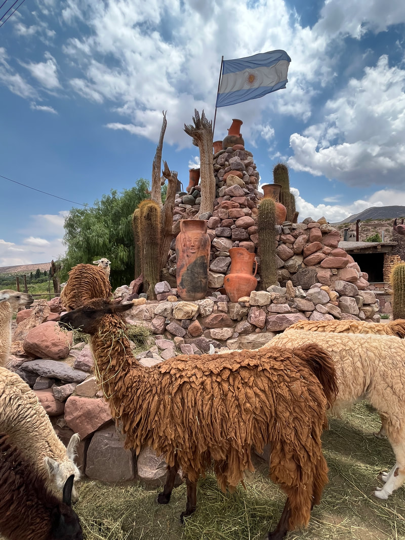
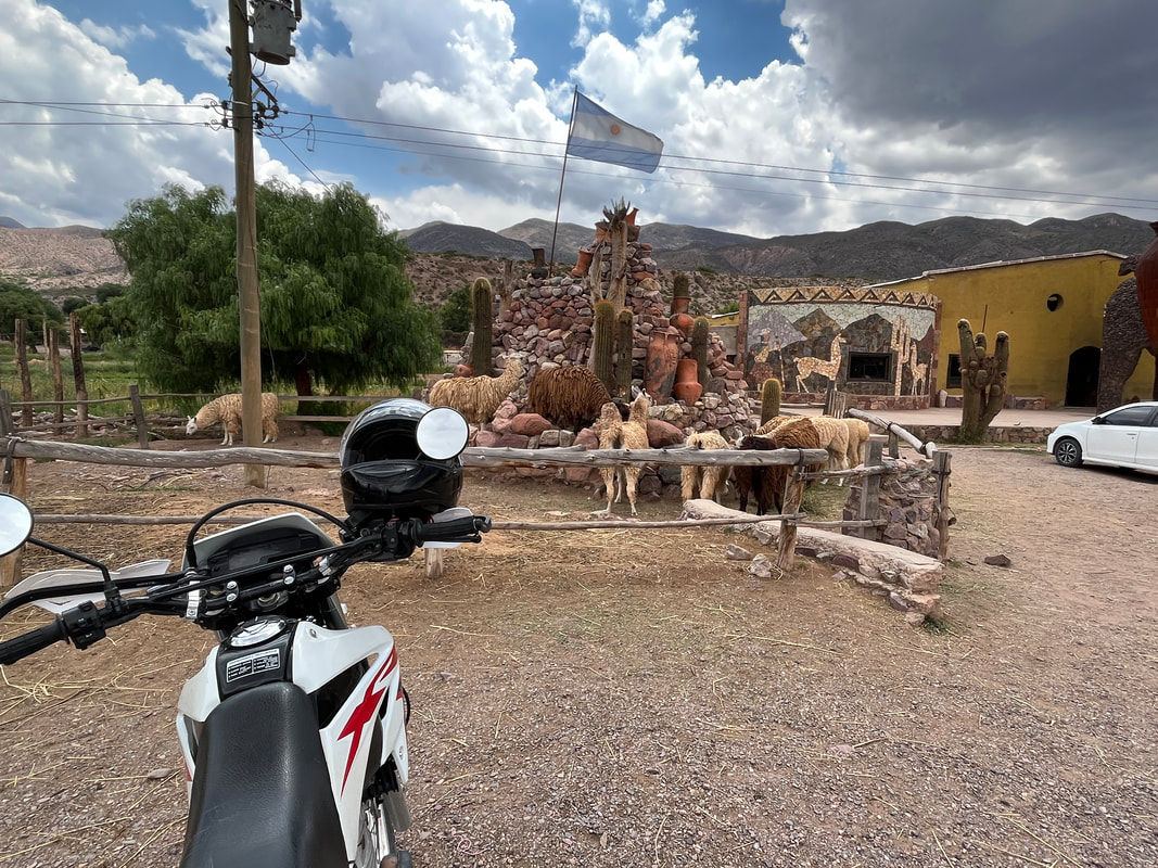
They looked so cute! Like tiny furry camels! They were white llamas and brown ones and they all had thick, matted coats - they were probably overdue for a shearing. They had been kept in a little paddock with a cairn in the middle, and an Argentinian flag flying from the top of the cairn. How cool was that - it was the perfect representation of Argentina.
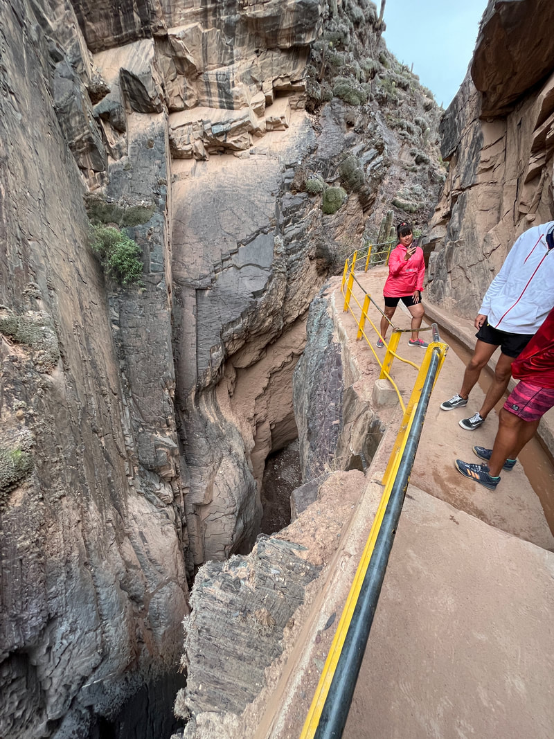
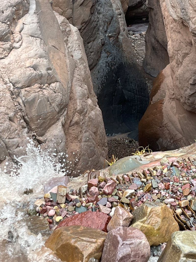
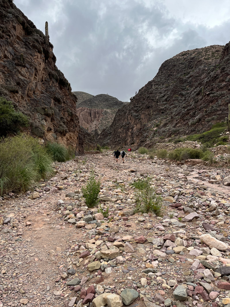
I rode back to Tilcara, and went off to check out the Gargante del diablo. It could be reached either by a 4 km walk or a 8 km drive - over dirt roads.
I really enjoyed that dirt track ride over the winding mountain path! It was so beautiful! And the bike performed well too! I reached the entry point of the waterfall and bought a ticket to go down and see the waterfall into the steep valley.
I really enjoyed that dirt track ride over the winding mountain path! It was so beautiful! And the bike performed well too! I reached the entry point of the waterfall and bought a ticket to go down and see the waterfall into the steep valley.
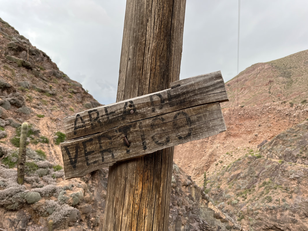
‘Area de vertigo!’ a sign warned me - and it was indeed an amazing sight. The canyon was a really deep and narrow gorge - you couldn’t even see the river at the bottom unless you were standing right at the edge of the gorge. The walking path had been created right at the lip of the gorge and was quite nice. If I wanted, I could have gone for a short hike to see the waterfall - but the rocky path did not really appeal. And the clouds looked pretty threatening too - all black and foreboding.
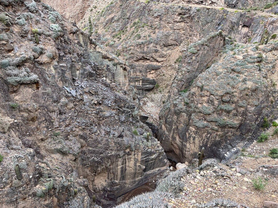
It was an awesome sight from the top of the gorge though - you could see the painted cliffs and the canyon of the river running through the scrubland. It had a very Arizona feel to it. The ride back was as enjoyable as the ride up - WOOHOO! The feel of riding an adventure bike on winding dirt roads on a mountain is amazing! The steep parts were not for a faint hearted driver, but there was no faint hearted driver around - so it was no problem! There was a stout… er…a stout-hearted rider - and he stood on the footpads and enjoyed the fantastic views of the surrounding mountains!
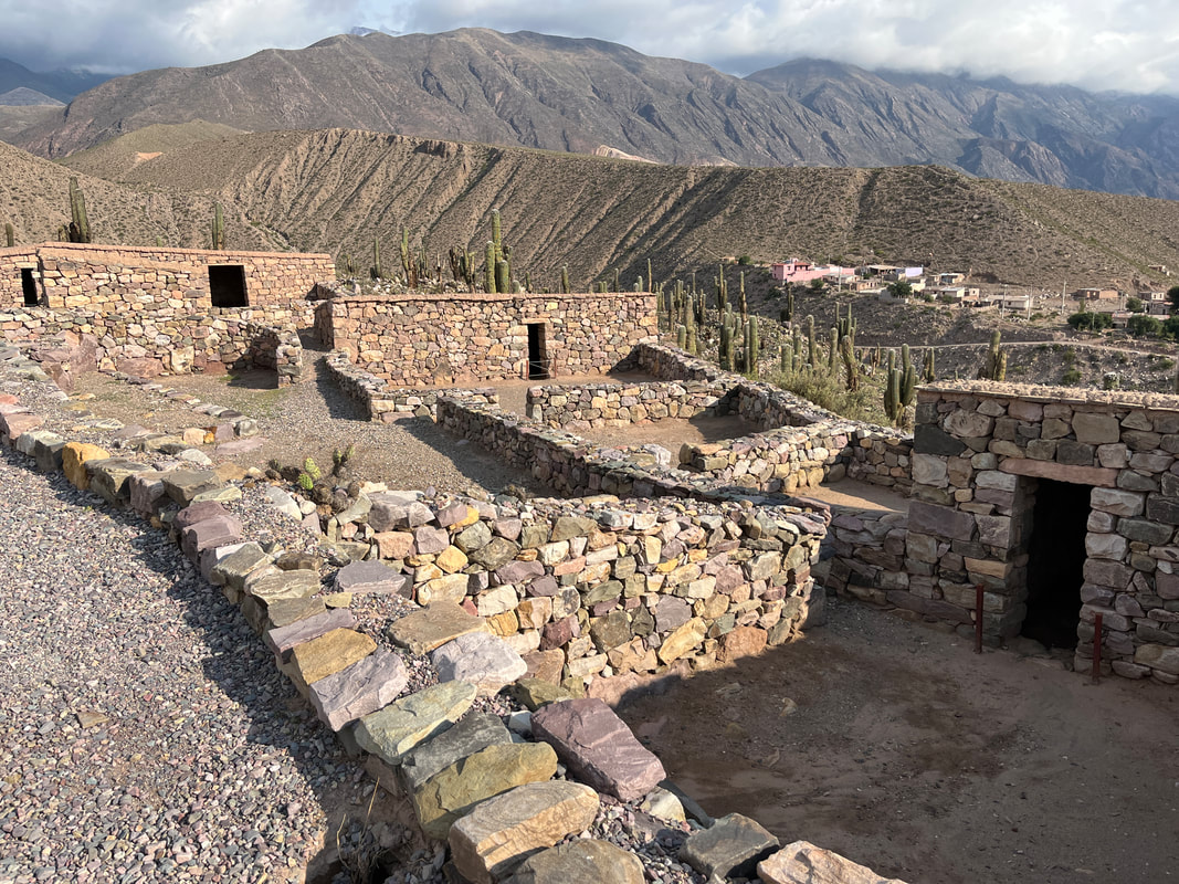
Once I got back to Tilcara, I went and checked out the ‘Pucara’ as well.
The Pucará de Tilcara is a pre-Inca fort located on a hill just outside Tilcara. The location was strategically chosen to be easily defensible and to provide good views over a long stretch of the Quebrada de Humahuaca.
The Pucará de Tilcara is a pre-Inca fort located on a hill just outside Tilcara. The location was strategically chosen to be easily defensible and to provide good views over a long stretch of the Quebrada de Humahuaca.
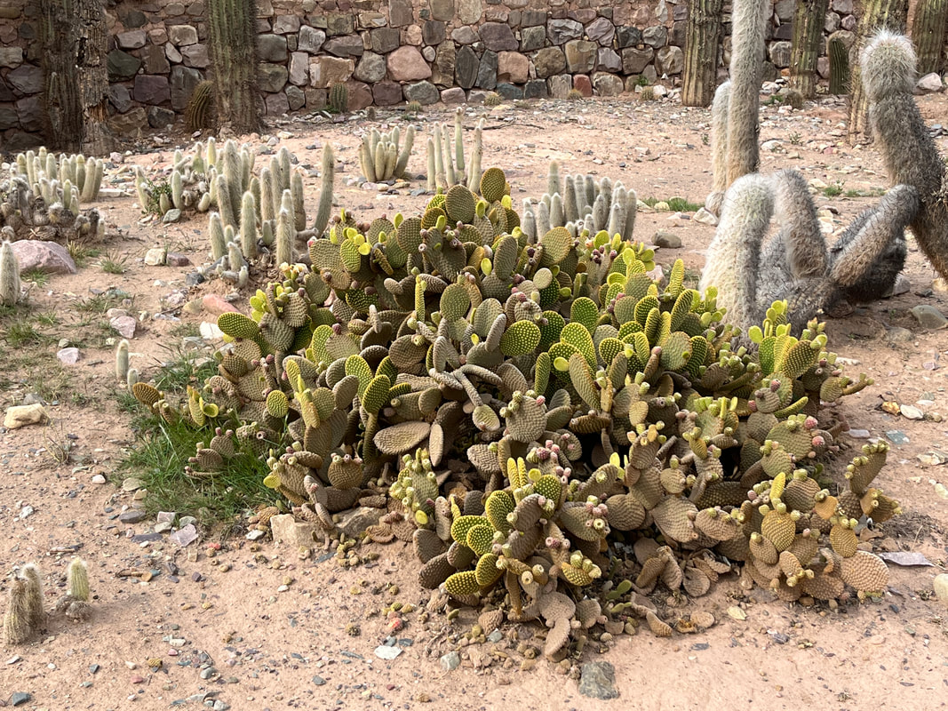
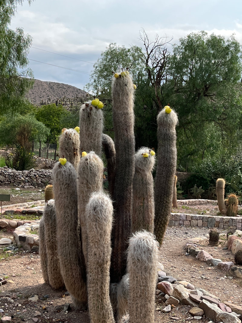
They had developed a ‘park’ outside the fort - and I wa very amused to see that it was dedicated purely to cacti! It was a ‘desert plant’ park and had many varieties of cactus. What a bunch of pricks!
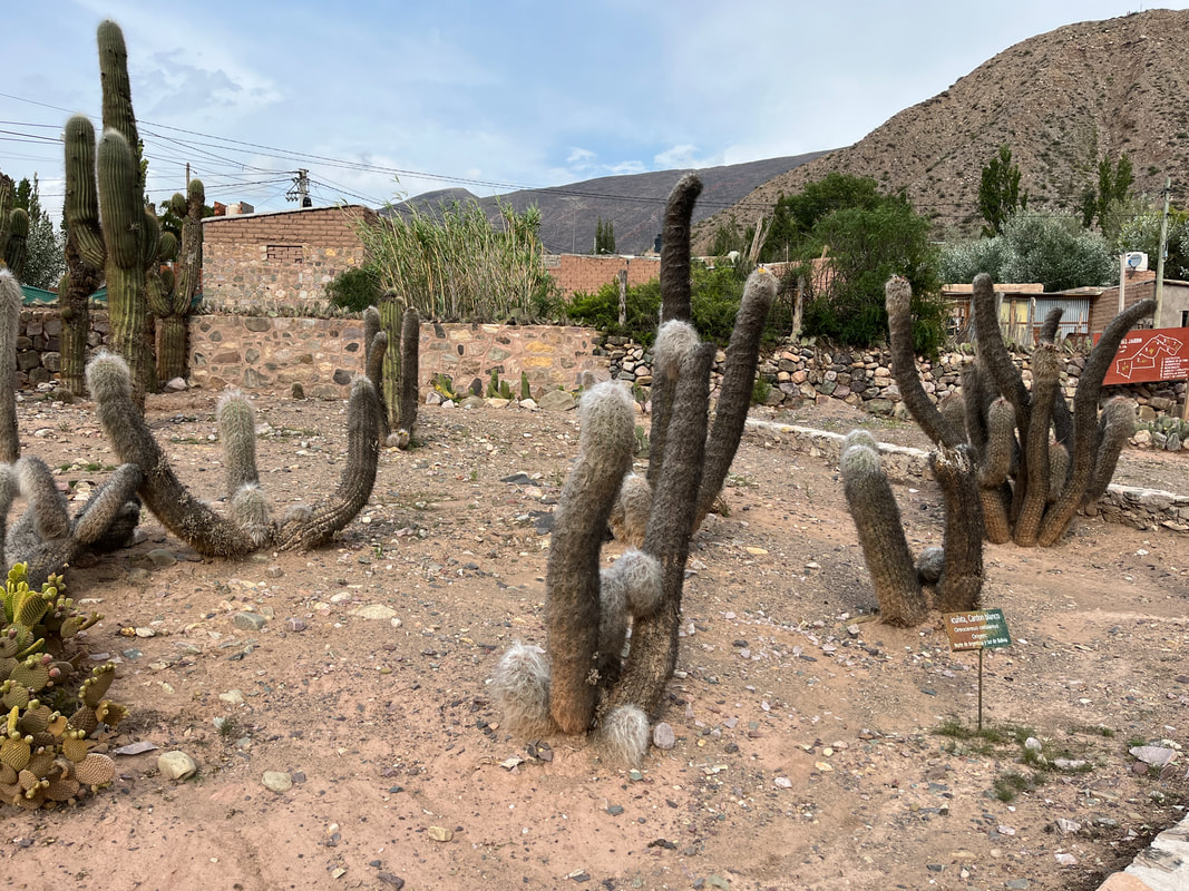
Just beyond the garden was the ancient fort. It had originally built by the Omaguaca tribe, who settled in the area around the 12th century. They were experts in agriculture, weaving and pottery - and during their time, the pucará served as an important administrative and military center.At its peak, the pucará covered up to about 15 acres (61,000 m2) and housed over 2,000 inhabitants, living in small square stone buildings with low doorways and no windows. Besides living quarters, the pucará contained corrals for animals, sites to perform religious ceremonies and burial sites.
In the late 15th century, the tribes of the Quebrada were finally conquered by the Incas under Tupac Inca Yupanqui, who used the pucará as a military outpost and to secure the supply of metals such as silver, zinc, and copper which were mined nearby. The Incan domination of the area only lasted for about half a century, and ended with the arrival of the Spanish in 1536, who founded the modern town of Tilcara in 1586.
In the late 15th century, the tribes of the Quebrada were finally conquered by the Incas under Tupac Inca Yupanqui, who used the pucará as a military outpost and to secure the supply of metals such as silver, zinc, and copper which were mined nearby. The Incan domination of the area only lasted for about half a century, and ended with the arrival of the Spanish in 1536, who founded the modern town of Tilcara in 1586.
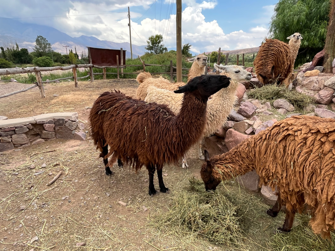
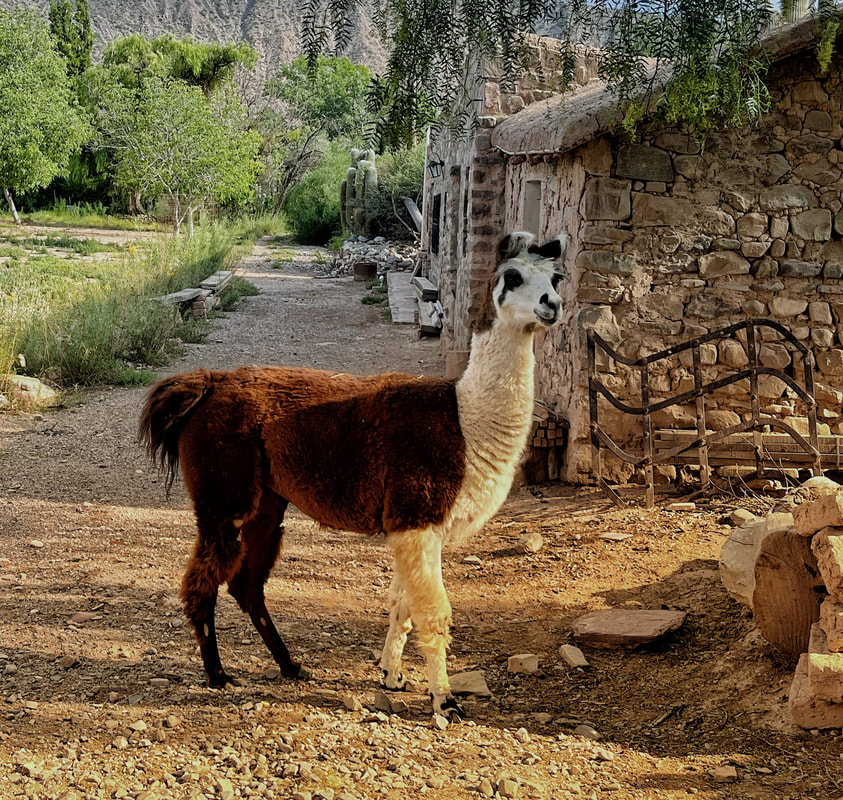
There were a couple of very royal Llamas there. They looked very different from the shaggy specimens I had seen earlier. These two looked like stock from the Inca’s royal herd! They had a beautiful two-toned coat in white and brown, and looked truly aristocratic! They ignored all the tourists in a most aristocratic way, and didn’t even look at us!
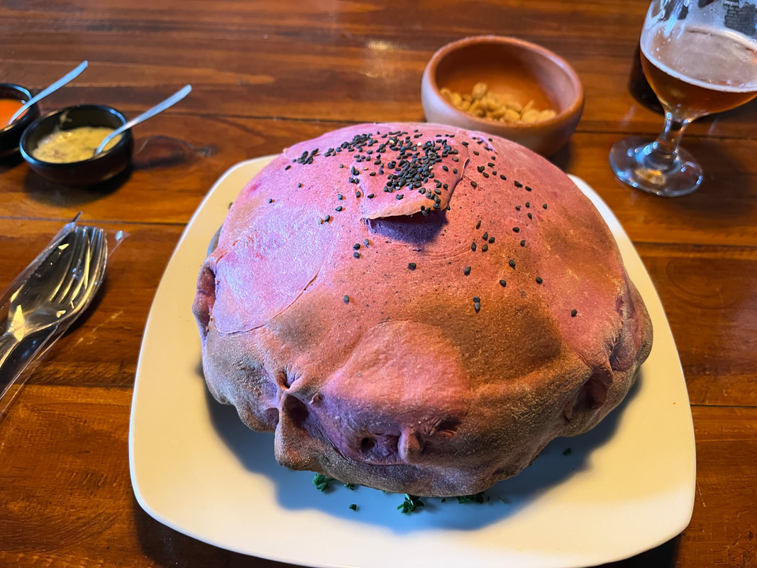
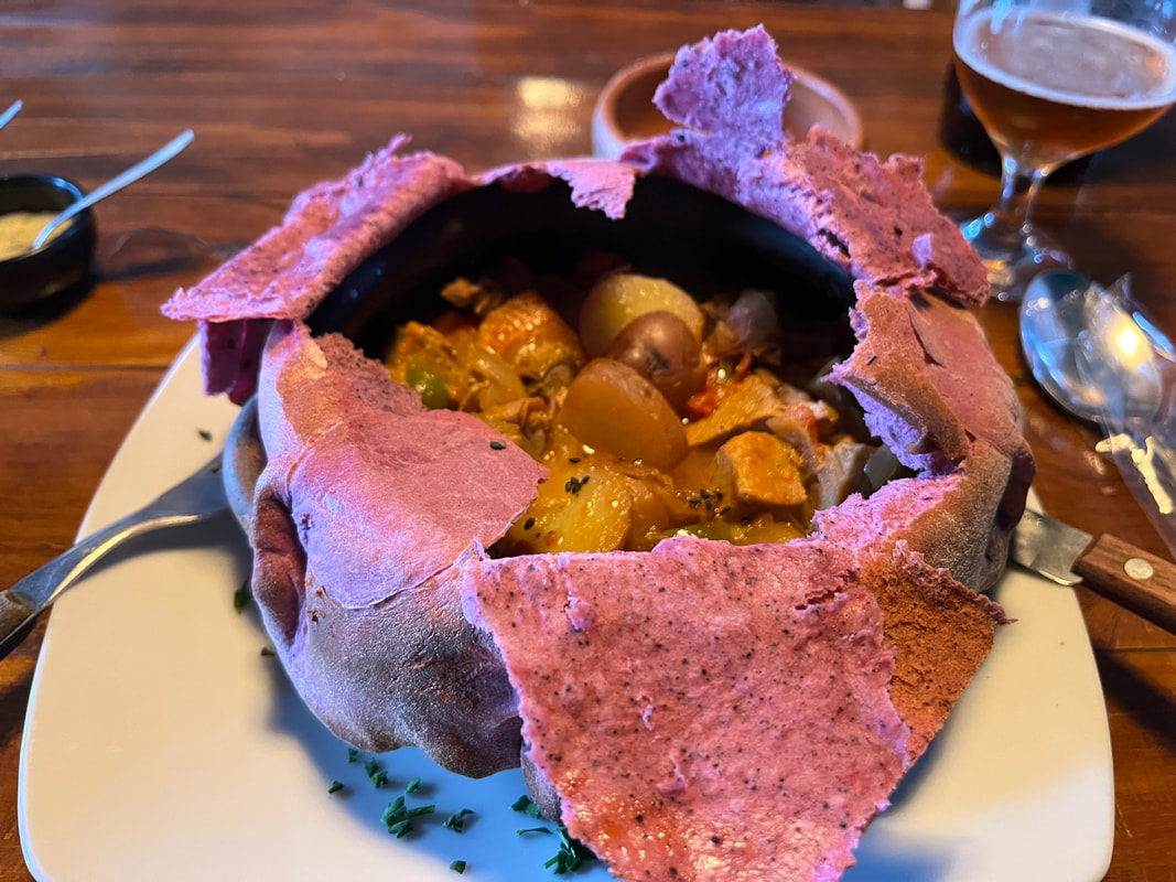
I was done with exploring for the day - and went back to the lovely restaurant I had eaten in yesterday and celebrated the end of the day with a beer and a special local stew.