Cafayate to Salta
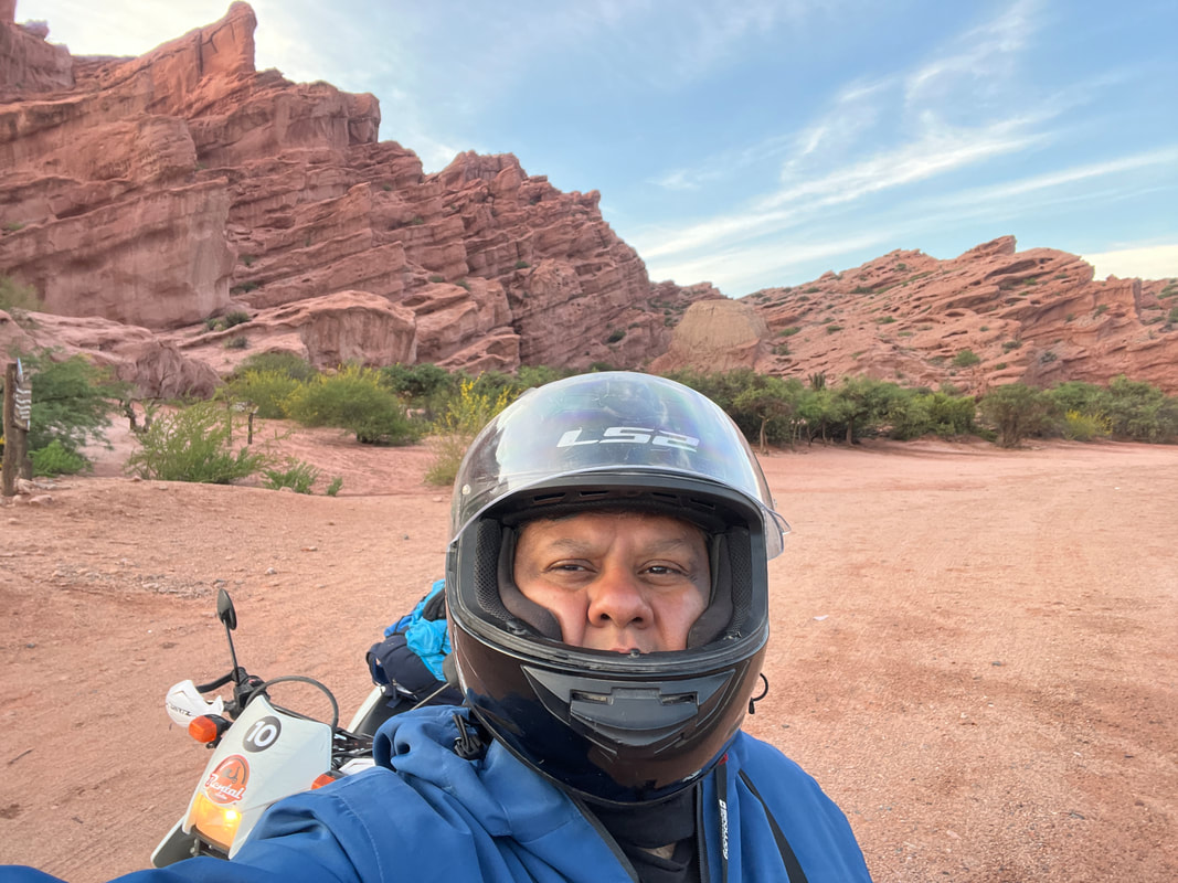
I awoke early the next morning and set out for Salta.
I was excited to do this route - the Cafayate to Salta route is supposed to be as - or more - beautiful as the Cachi- Cafayate route - and was paved and tarred! Woohoo! Less adventure - but more chance of seeing the scenery around without landing up in a ditch.
I was excited to do this route - the Cafayate to Salta route is supposed to be as - or more - beautiful as the Cachi- Cafayate route - and was paved and tarred! Woohoo! Less adventure - but more chance of seeing the scenery around without landing up in a ditch.
The route from Cafayate was simply awesome! Fantastic!
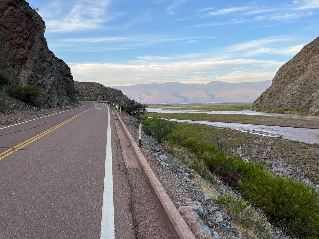
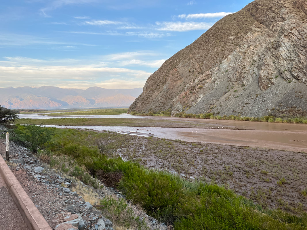
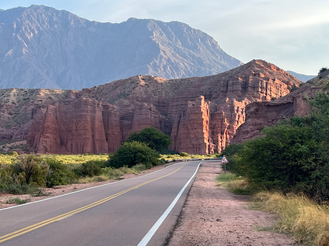
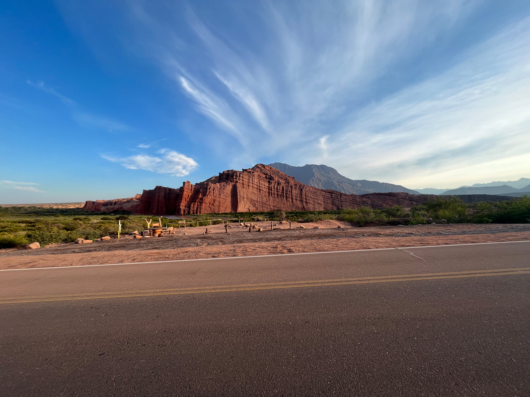
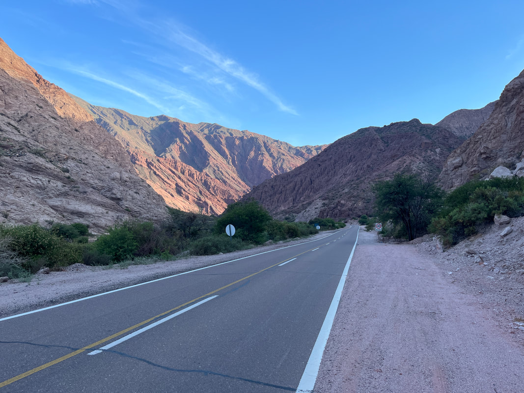
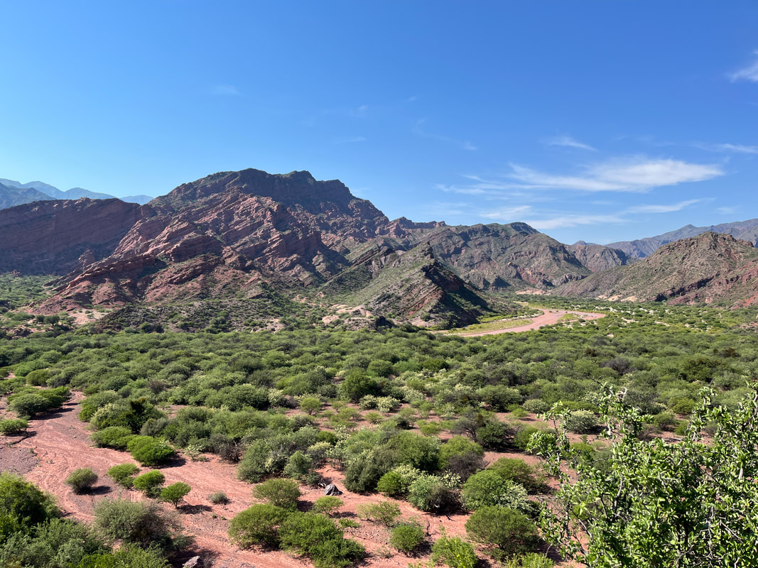
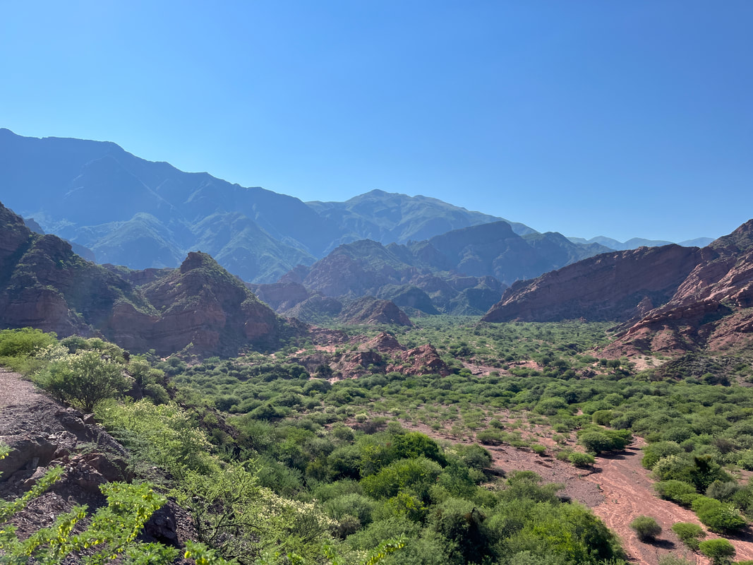
The road follows the ‘Quebrada de las Conchas’ - the valley of the Conchas river - and goes through some amazing scenery, with the river on one side and brick red mountains on the other. The Quebrada de las Conchas is home to some of the country's most impressive rock formations - this deep canyon is framed by extraordinary rock walls showcasing layers of stunning colors, from deep red to vivid green to cobalt blue. Millennia of wind, rain, cold, and harsh weather conditions have carved and eroded the rocks into unusual shapes, creating a visual feast for all who travel along this winding route.
The road follows the ‘Quebrada de las Conchas’ - the valley of the Conchas river - and goes through some amazing scenery, with the river on one side and brick red mountains on the other. The Quebrada de las Conchas is home to some of the country's most impressive rock formations - this deep canyon is framed by extraordinary rock walls showcasing layers of stunning colors, from deep red to vivid green to cobalt blue. Millennia of wind, rain, cold, and harsh weather conditions have carved and eroded the rocks into unusual shapes, creating a visual feast for all who travel along this winding route.
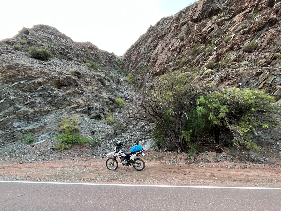
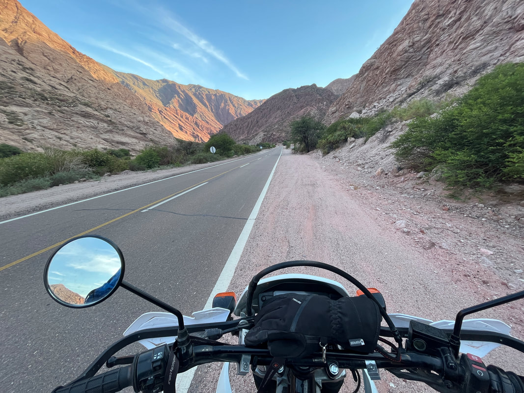
It was early morning and the air was fresh and cool. The sun had not risen above the top of the mountains, and so the road was in shadow and thus was cool and comfortable. The road was amazingly smooth and well-maintained and by bike was running smoothly! What more can a man ask for?
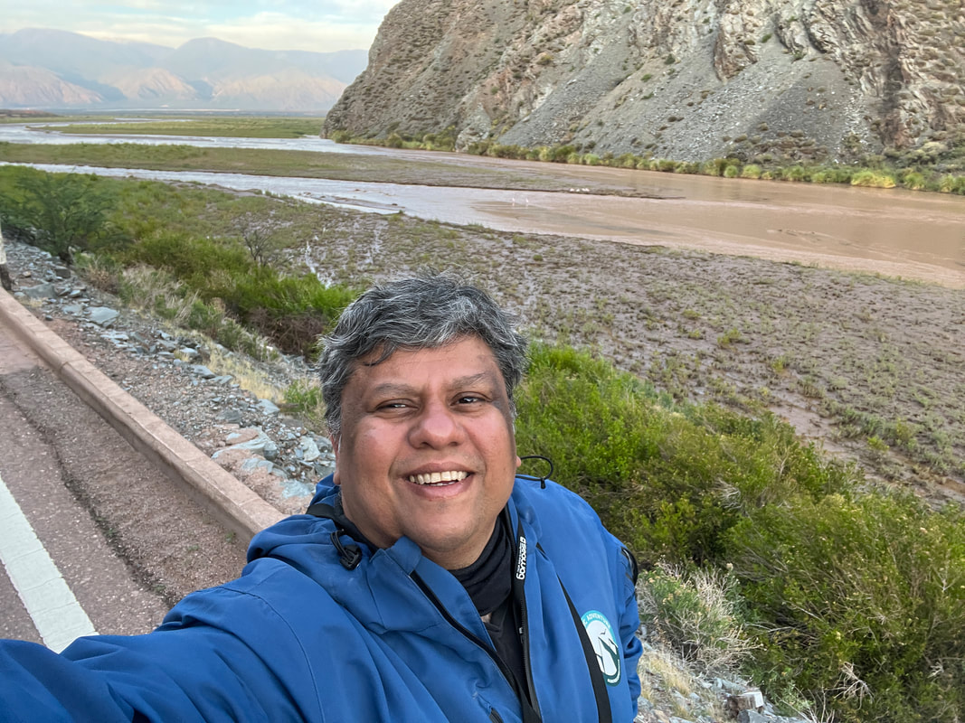
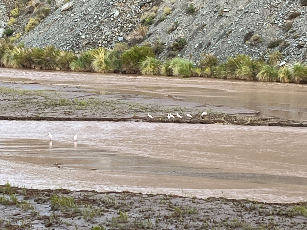
The road was so beautiful that I was stopping every few minutes and getting off to the admire the place. It seemed to me that I was spending more time off the bike than on! The beautiful slow river flowing through the mountains - brown flowing through reddish brown, brilliantly white birds dotted through it, bright blue skies, cottony white clouds, a small lining of green grass and rushes…it was mind-blowing. Mind soothing. Mind refreshing. Mind numbing. Mind renewing.
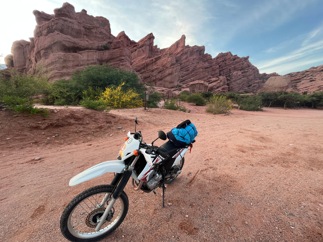
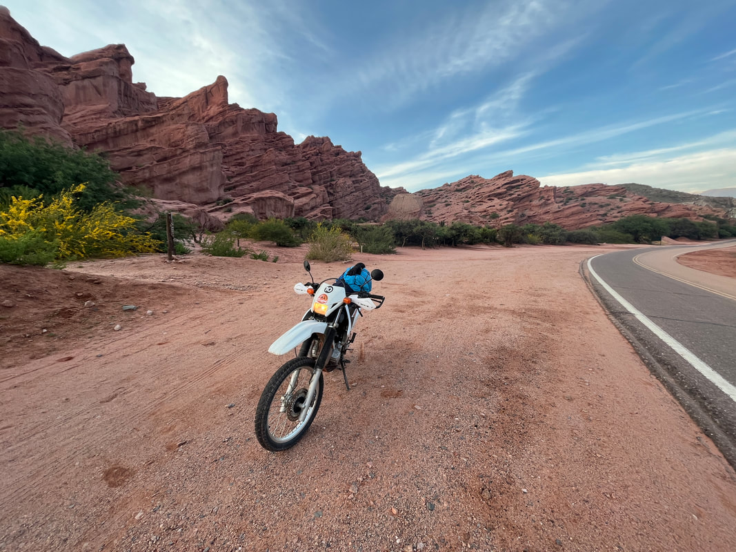
Within 20 minutes of leaving Cafayate, the rocks turned a rusty-red colour and started to rise up around us. The unearthly scenery reminded me a lot of the USA – particularly Sedona and the beautiful red-rock regions of Arizona. I had to restrain myself from pulling over every 30 seconds to take a photo, as it was all so jaw-droppingly beautiful.
It was breathtaking stuff! And I had not even reached the ‘Miradors’ - the ‘points to see’ - yet.
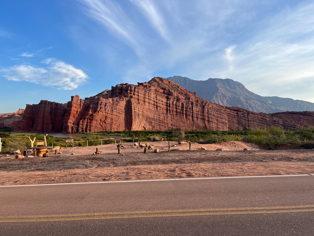
The first one was the awesome red cliffs of the ‘Los Colorados’ - ‘the red rocks’.
(Wow - I had no idea that the name of the American state of Colorado literally just meant ‘Red rocks’. But then, I suppose most Americans dont know that ‘Grand Tetons’ literally means ‘Big breasts’.)
It was breathtaking stuff! And I had not even reached the ‘Miradors’ - the ‘points to see’ - yet.
The first one was the awesome red cliffs of the ‘Los Colorados’ - ‘the red rocks’.
(Wow - I had no idea that the name of the American state of Colorado literally just meant ‘Red rocks’. But then, I suppose most Americans dont know that ‘Grand Tetons’ literally means ‘Big breasts’.)
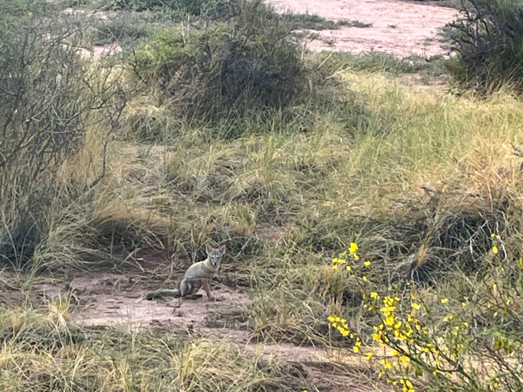
I stopped near the rocks to admire them, and suddenly my eye caught a movement in the shrubbery. I stopped to look more carefully - and it was a fox!
A fox!
Zorro himself! WOOHOO! I am always stoked to see wildlife in its element!
A fox!
Zorro himself! WOOHOO! I am always stoked to see wildlife in its element!
You have a whole bunch of awesome and beautiful rock and mountain formations along this route - the next one was called the Los Castillos (The Castles) .Years of erosion have carved away at the red rock face creating impressive columns and towers that help give The Castle its majestic appearance.
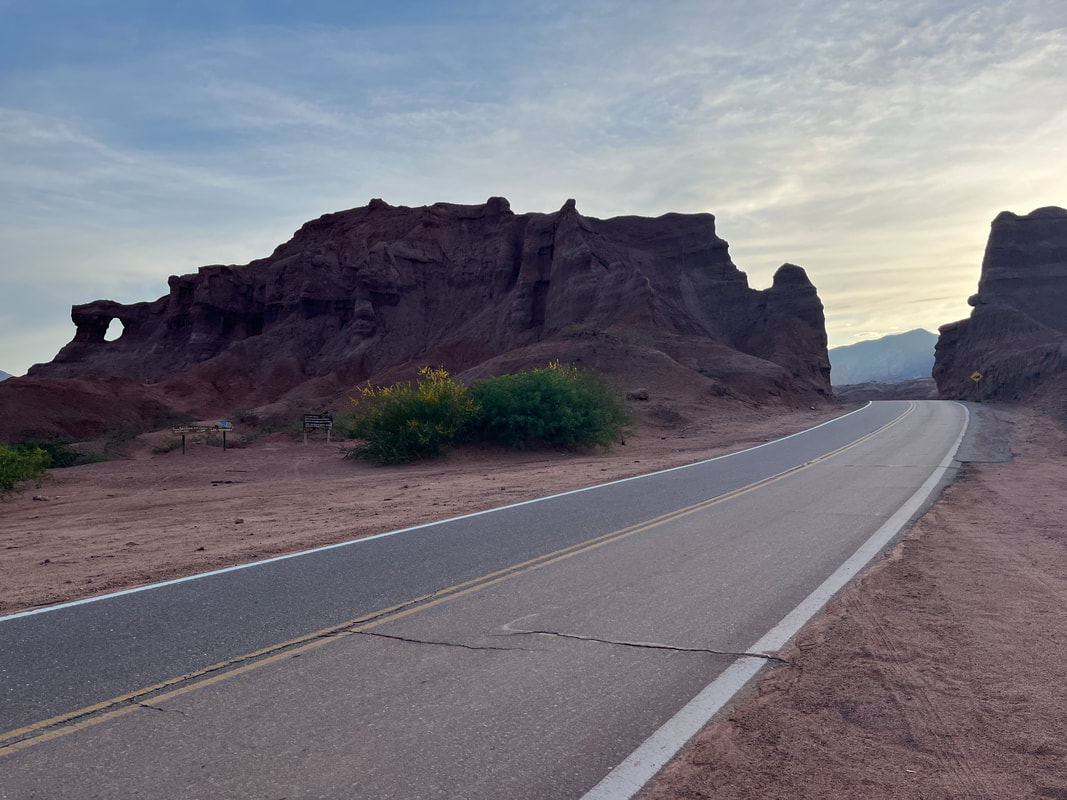
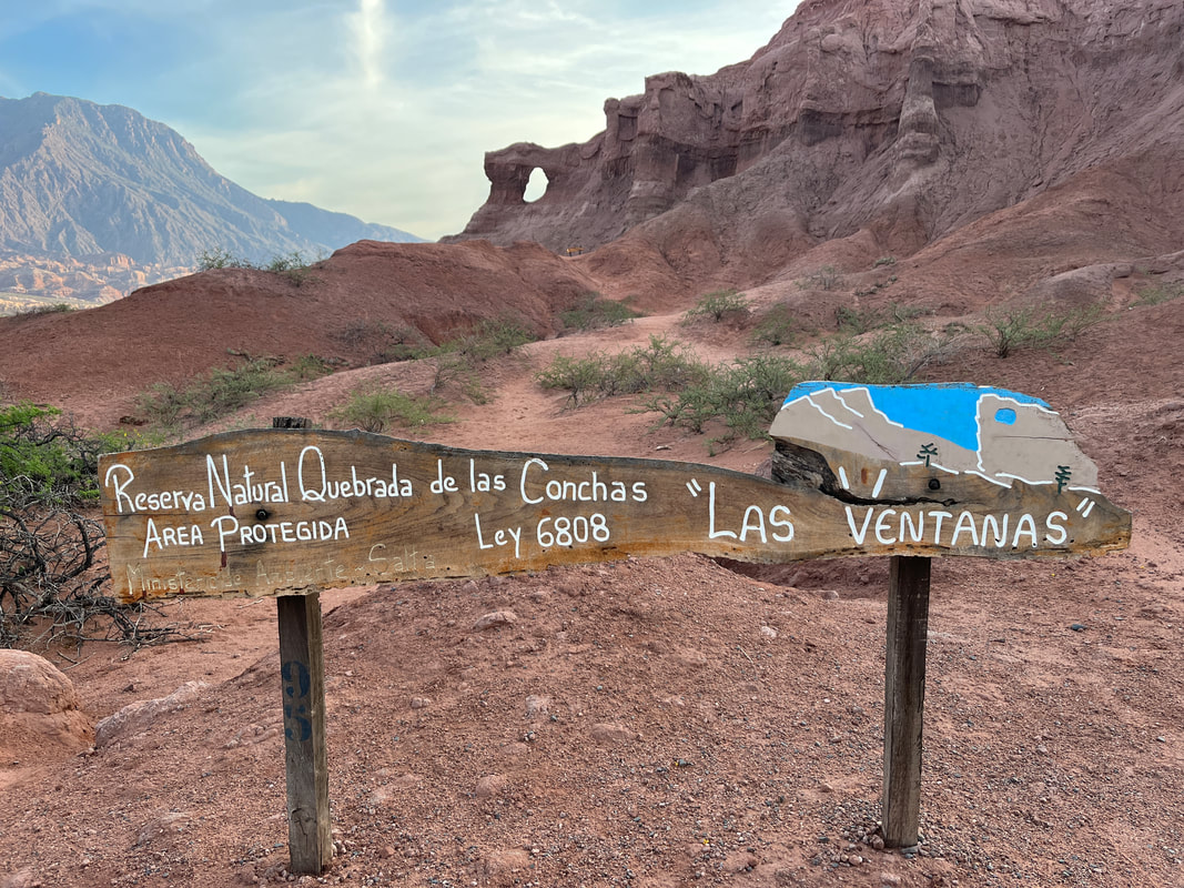
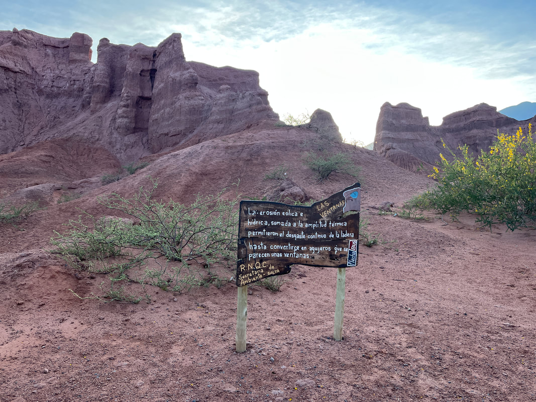
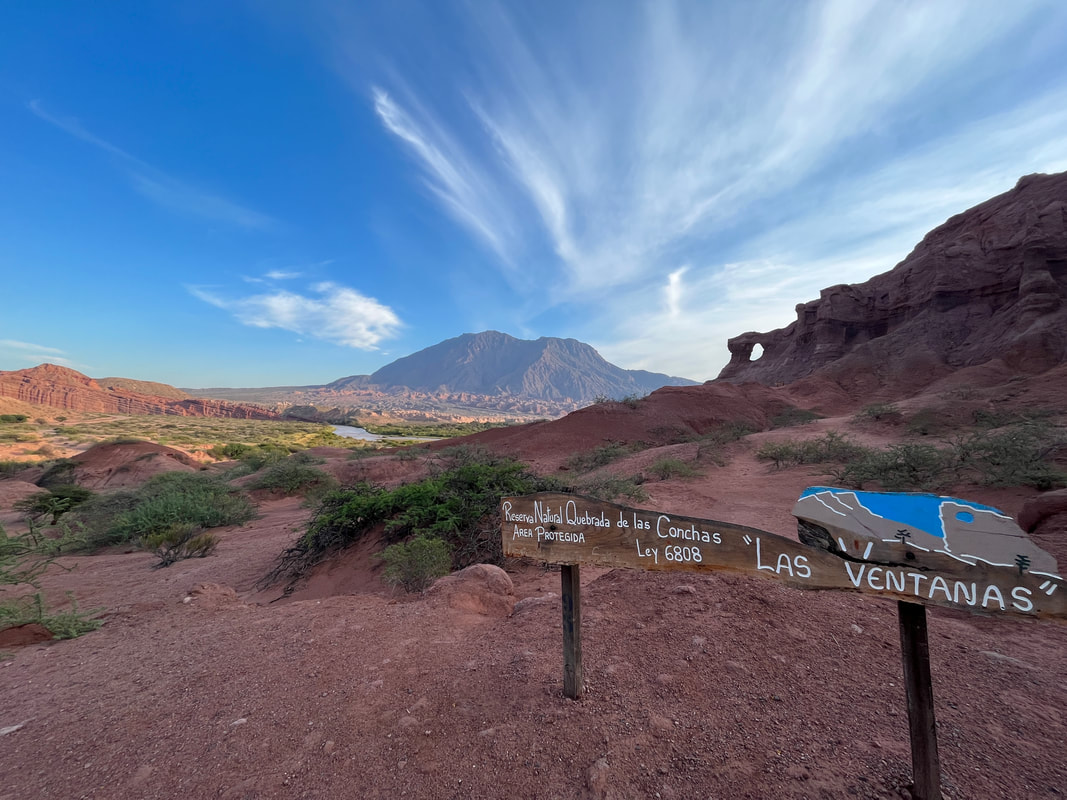
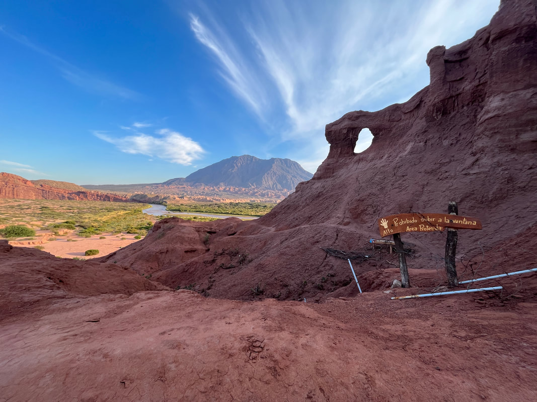
Then there was a point called ‘Las ventanas’ - ‘the window’ - because there was a huge hole in a whole mountain wall. I stopped there and went walking up a trail to take a closer view. Someone had put up a hand-painted sign there - ‘THE WINDOWS - Wind and water erosion, added to the thermal amplitude, allowed the continuous erosion of the slope until they become holes that look like windows.’
The amateurishness of the sign and the painting was somehow very endearing. It seemed that the local people had come together to do a community project, rather than an efficient but rather soulless sign made by a professional road building company.
The amateurishness of the sign and the painting was somehow very endearing. It seemed that the local people had come together to do a community project, rather than an efficient but rather soulless sign made by a professional road building company.
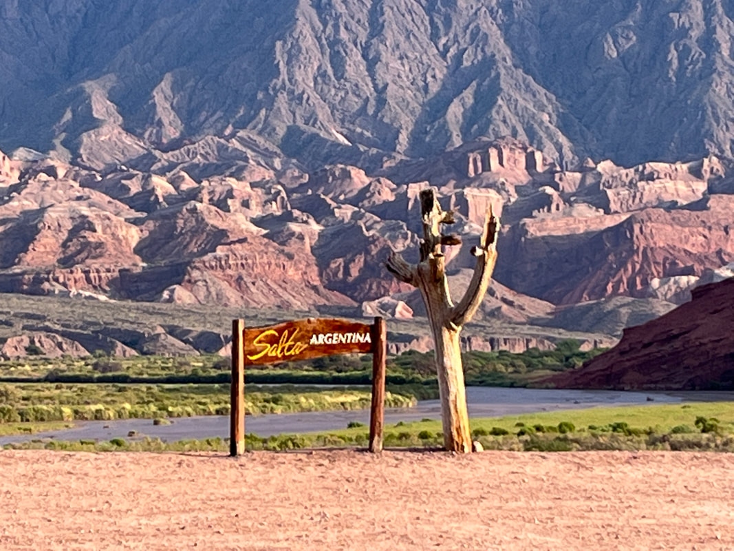
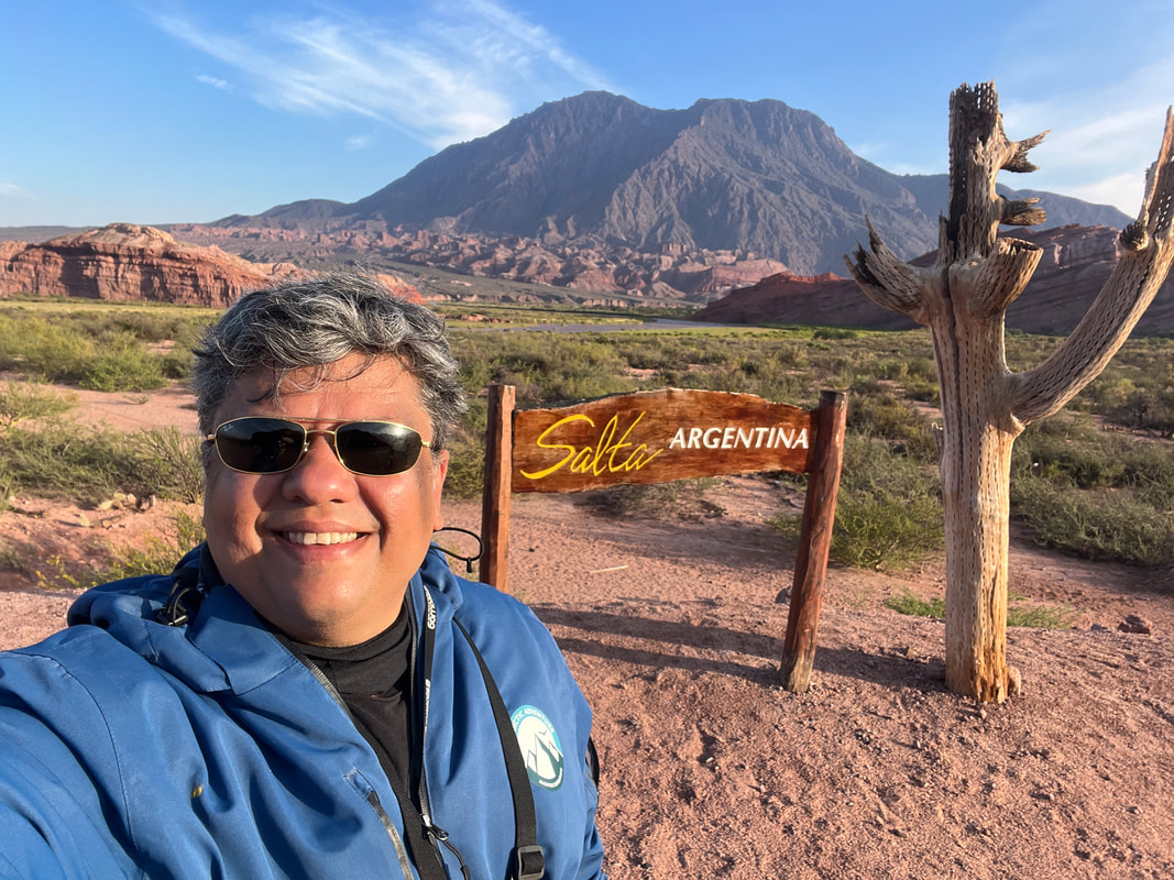
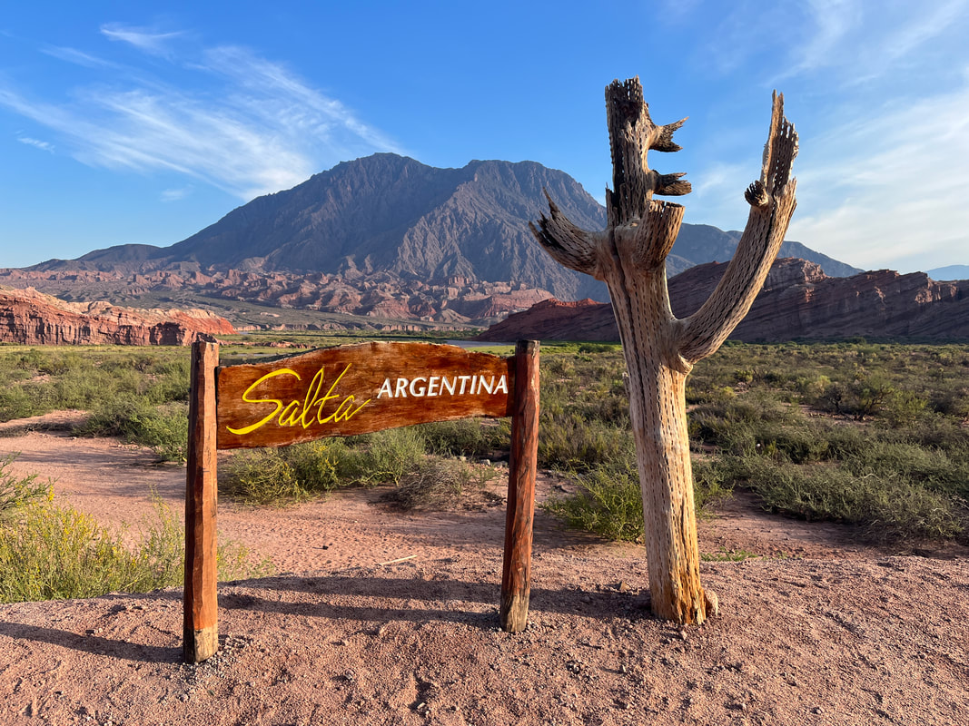
I passed a lovely ‘selfie point’ with a cartel saying ‘Salta Argentina’ in front of a lovely mountain range and of course I had to stop and take a bunch of photos there
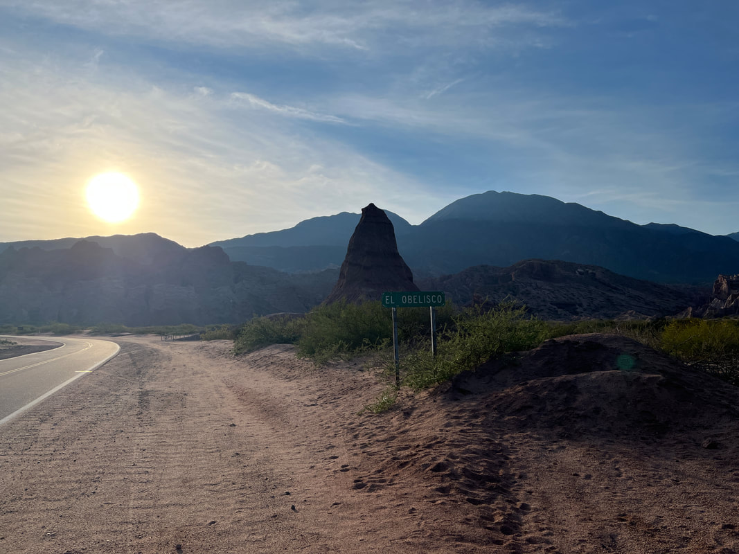
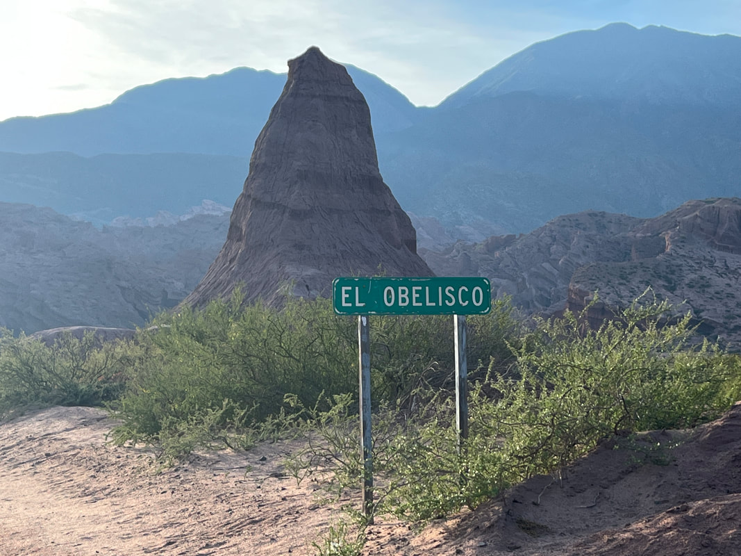
And then I came to the ‘Obelisk’.
Standing tall and proud, El Obelisco is a tower of sandstone and clay. Measuring more than 26 meters, El Obelisco is so smooth and straight you'll have a hard time believing it
Standing tall and proud, El Obelisco is a tower of sandstone and clay. Measuring more than 26 meters, El Obelisco is so smooth and straight you'll have a hard time believing it
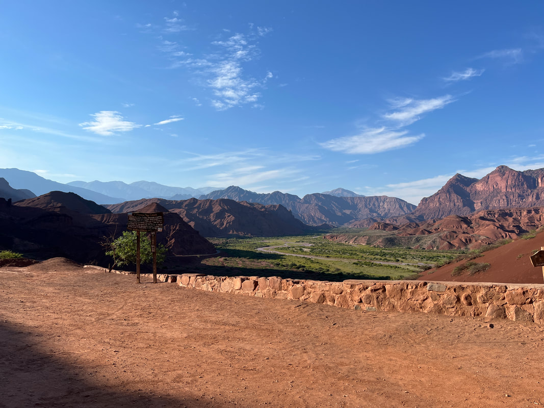
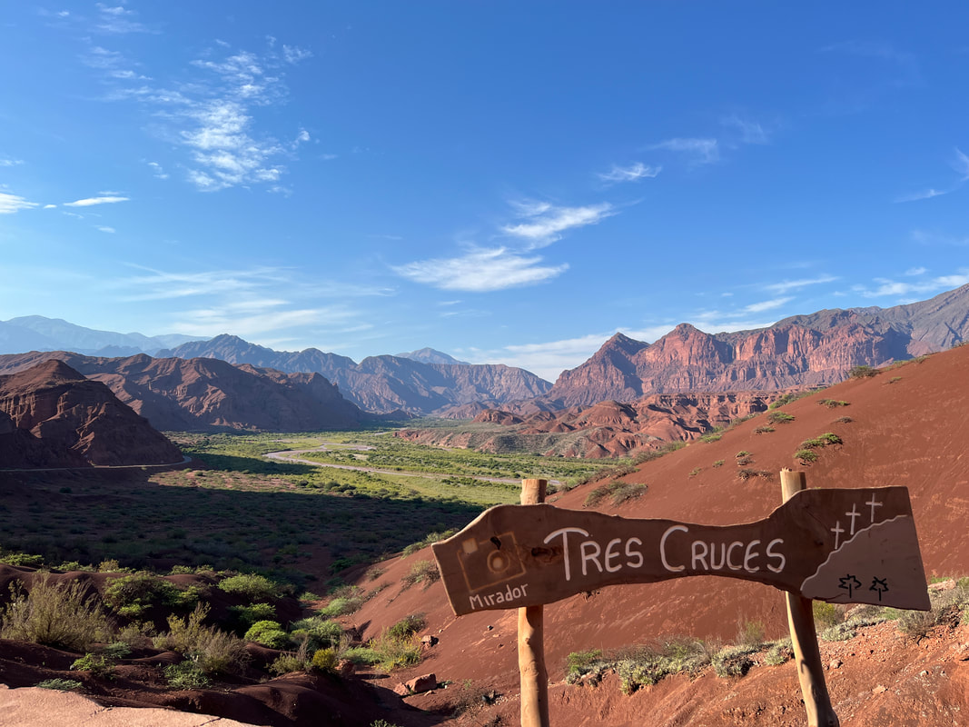
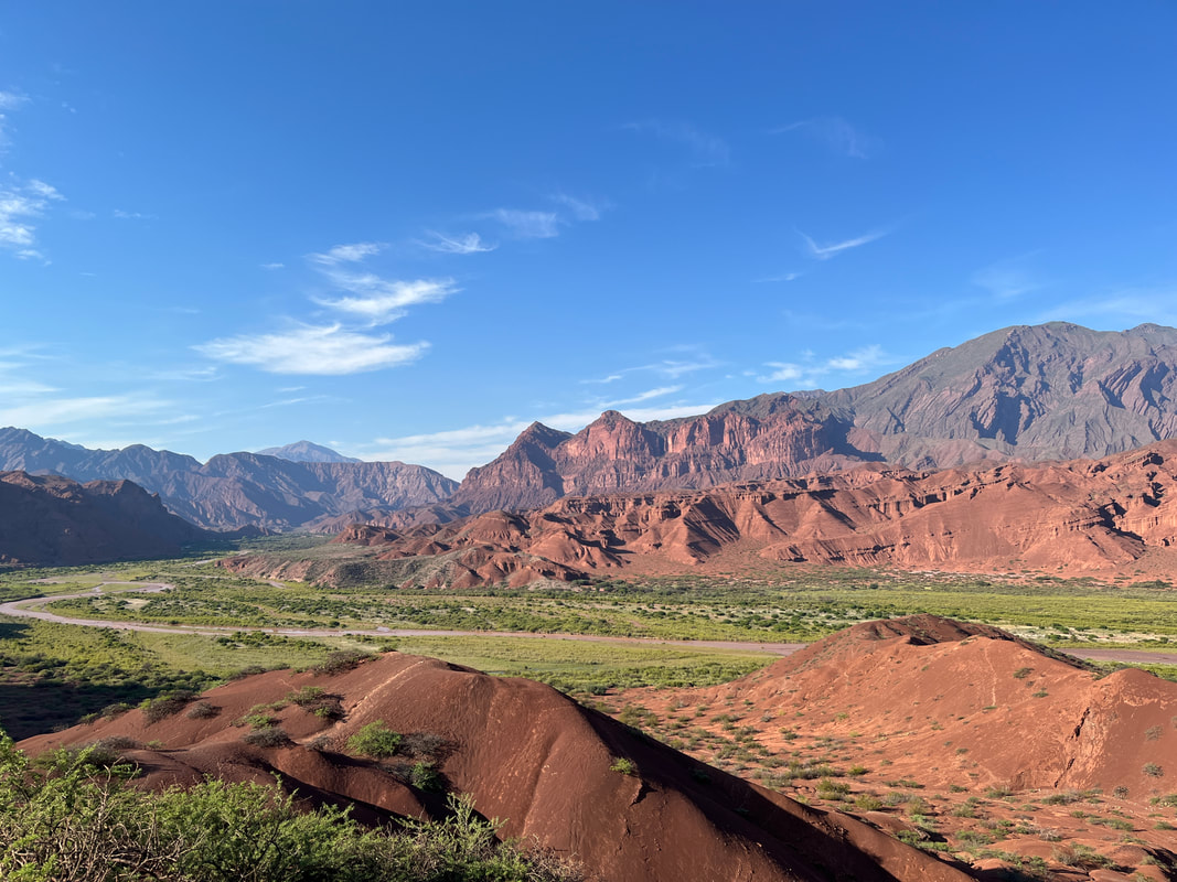
A further 20 minutes of awesome scenery later, I arrived at the most impressive view-point of all: Las Tres Cruces (or ‘The Three Crosses’). A short walk up from the parking area and I was greeted with the most breath-taking 360-degree views of the Calchaqui Valley below. The view down the meandering river where the green of the valley vegetation contrasts against the red of the sandstone cliffs is really quite epic.
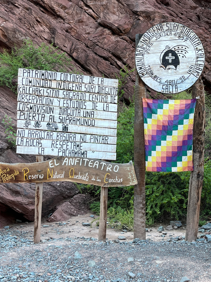
El Anfiteatro – a natural amphitheatre, apparently known for its incredible acoustics. Apparently, If you’re lucky, you can catch guitarists, panpipe players, and even choirs demonstrating this natural wonder. Sadly, there were no performances for me as it was too early in the day - but it was still awe-inspiring to stand at the bottom of the giant canyon – I suddenly felt very small and insignificant, surrounded by all that natural beauty!
Surrounded by 20-meter tall walls, El Anfiteatro is a flat surface that is fully accessible on foot. Stand in the center, look straight up at the clear blue sky and take in the near-perfect acoustics in this natural wonder.
Surrounded by 20-meter tall walls, El Anfiteatro is a flat surface that is fully accessible on foot. Stand in the center, look straight up at the clear blue sky and take in the near-perfect acoustics in this natural wonder.
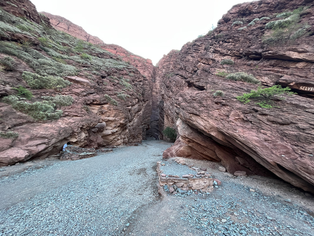
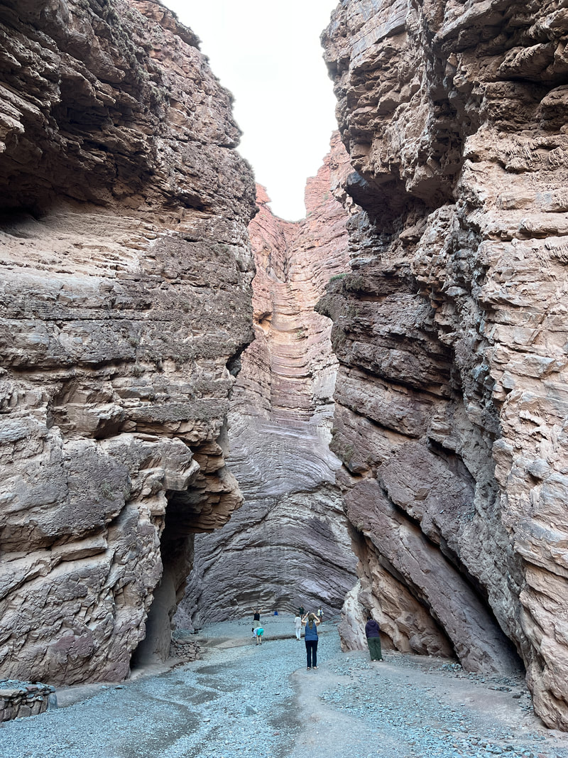
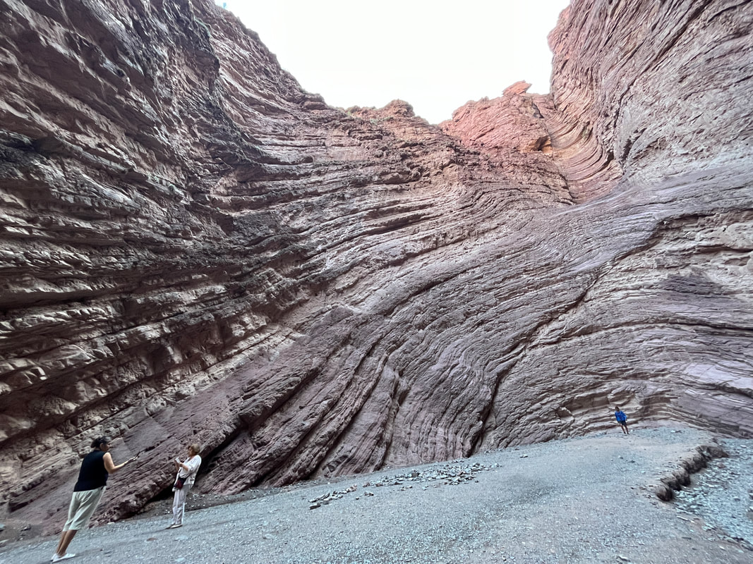
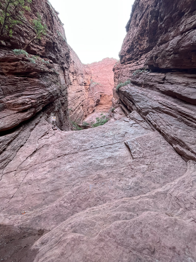
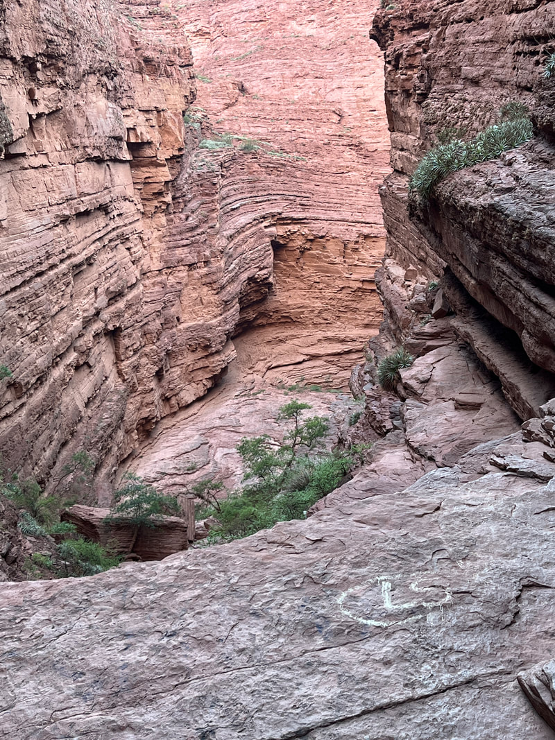
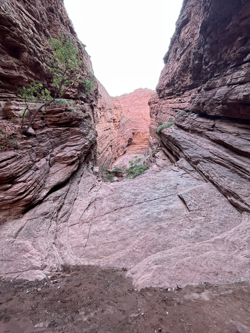
Garganta del Diablo (Devil’s Throat).
These Argentinians really like this name - I had already seen one at Iguazu falls, and there was another one in Jujuy. Basically, anytime they see a large valley or canyon, they go ‘SI SI… GARGANTA DEL DIABLO…SEE SEE...’
I am sure even their deep-throating porn stars must also be called ‘Garganta del diablo’
The Devil's Throat or Garganta del Diablo is one of Quebrada de las Conchas' main attractions, and the last on the way to Salta. A narrow canyon of rock, the layers are split in two given visitors the impression they are standing at the back of a throat. Walk to the middle of the canyon and feel very small as you look up at the blue sky through the rocks' narrow opening.
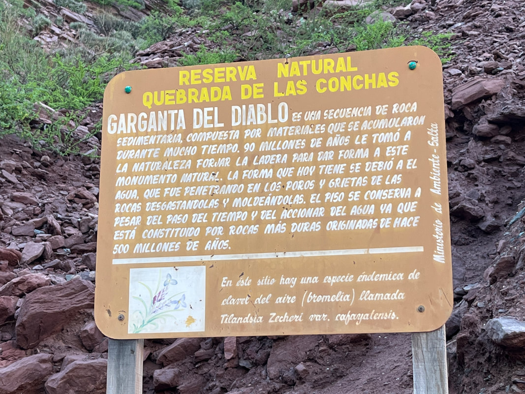
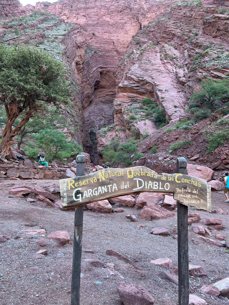
The deep throat was the last ‘mirador’ and after that it was a beautiful route through the quebrada. Interestingly, the name ‘Las Conchas’ means ‘Sea shells’. Millions of years ago, the Quebrada de las Conchas was covered by an enormous inland sea. Most remains of the sea have disappeared, save for a few fossils and seashells that dot the land. Even now you can see deposits of fossilised fish, seashells and salt that are found throughout the valley.
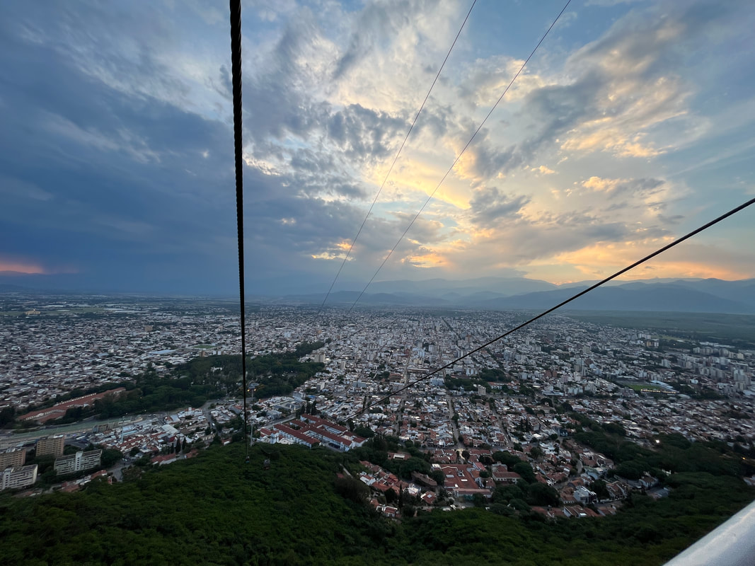
the cable car - the Teleferico San Bernardo. This cable car takes you to the top of San Bernardo´s Hill where you can enjoy a view of the Lerma Valley.
The view on the way down was very interesting - a huge mass of clouds had developed, and it was rumbling and throwing lightning bolts!
It was awesome and great to see - but I gulped a bit on seeing the massive lightning show.
I had to ride tomorrow!
I hope it doesn’t rain too much!
The view on the way down was very interesting - a huge mass of clouds had developed, and it was rumbling and throwing lightning bolts!
It was awesome and great to see - but I gulped a bit on seeing the massive lightning show.
I had to ride tomorrow!
I hope it doesn’t rain too much!